
for Tuesday, 06 October 2009 [11:39 AM PST]


<<<Typhoon2000.com Mobile >>>
Get the latest 6-hrly SMS Storm Alerts on PEPENG!
For more details: Text T2K TYPHOON to
2800 (Globe/TM) | 216 (Smart/TNT) | 2288 (Sun)
*only P2.50 (Smart/Globe) / P2.00 (Sun) per msg received.
powered by: Synermaxx
Typhoon2000 (T2K) NEWS (Mon October 05 2009):
Currently issuing 6-hrly advisories (except 12:00 AM) on TS PARMA (PEPENG).
PARMA (PEPENG) MAX WIND SPEED PER AGENCY:
+ Korea (KMA/10-min avg): 120 km/hr
+ Japan (JMA/10-min avg): 110 km/hr
+ Hong Kong (HKO/10-min avg): 110 km/hr
+ Philippines (PAGASA/10-min avg): 105 km/hr
+ Beijing (NMC/2-min avg): 105 kph
+ Taiwan (CWB/10-min avg): 100 km/hr
+ USA (JTWC/1-min avg): 100 km/hr
TROPICAL STORM PARMA [PEPENG/19W/0917]
T2K PUBLIC ADVISORY NUMBER 025
12:00 PM PST (04:00 GMT) Tue 06 October 2009
Source: T2K ANALYSIS / JTWC WARNING #034
View: Advisory Archives (2004-2009)
Tropical Storm PARMA (PEPENG) approaching the western & northern coastlines of Ilocos Norte...Deteriorating weather condtions expected along Extreme Northern Luzon...Direct Cyclone Interaction (aka. Fujiwhara Effect) continues w/ Typhoon MELOR (QUEDAN).
*Residents and visitors along Northern Luzon & Southern China should closely monitor the progress of PARMA.
*Kindly refer to your local warnings & bulletins issued by your country's official weather agency. This advisory is intended for additional information purposes only.
+ Forecast Outlook: PARMA is expected to continue drifting south slowly towards the coast of Ilocos Norte for the next 2 to 3 days. The 3 to 5-day Long-Range Forecast shows PARMA turning WSW to westward across the South China Sea on Friday Oct 9. Stormy weather expected across portions of NW Luzon particularly Ilocos provinces down to La Union, Pangasinan and Zambales. *Alternate Forecast Scenario: There are some models showing PARMA making landfall along Ilocos Norte and Ilocos Sur, traversing La Union and Benguet before heading west across Pangasinan between tonight until Thursday, Oct 8. This scenario cannot be ruled out at this time.
+ Effects: PARMA's main circulation remains slightly organized with its core reforming just off the coast of Ilocos Norte...Stormy conditions w/ winds not exceeding 130 kph can be expected along Ilocos Provinces and the rest of Extreme Northern Luzon...while its inner (rain) bands are now spreading across other parts of Northern Luzon - where deteriorating weather conditions w/ winds not exceeding 85 kph can be expected today. Northern parts of Central Luzon will be under PARMA's outer (feeder) bands), where cloudy skies, light to moderate rains w/ winds not exceeding 60 kph can be expected. 1-day rainfall accumulations of 50 up to 100 mm (moderate to heavy rain) can be expected along PARMA's rainbands...with isolated accumulations of up to 200 mm (very heavy rain) near the center of PARMA. Residents in low-lying areas & steep slopes must remain alert & seek evacuation for possible life-threatening flash floods, mudslides & landslides due to the anticipated heavy rains brought about by this system. Precautionary measures must be initiated if necessary. Possible coastal Storm Surge flooding of 1 to 3 feet above normal tide levels...accompanied by large and dangerous battering waves...is possible along the coastal areas of Extreme NW Luzon. Very minimal damage is likely on this type of storm surge.
+ Tropical Cyclone Watch:
(1) Typhoon MELOR (QUEDAN) beginning to recurve towards Southern Japan...expected to exit PAR later tonight. Click here to view latest T2K advisory.
Kindly click the cool T2K Graphical Satellite Analysis, issued every afternoon, and shows various tropical systems roaming across the South China Sea and the Western Pacific Ocean.
[Important Note: Please keep in mind that the above forecast outlook, effects, current monsoon intensity, & tropical cyclone watch changes every 6 to 12 hrs!]
Time/Date: 12:00 PM PST Tue October 06 2009
Location of Center: 19.2º N Lat 120.3º E Lon
Distance 1: 115 km (63 nm) NNW of Laoag City
Distance 2: 125 km (67 nm) West of Calayan Is.
Distance 3: 180 km (97 nm) North of Vigan City
Distance 4: 230 km (125 nm) SW of Basco, Batanes
Distance 5: 315 km (170 nm) NNW of Baguio City
Distance 6: 355 km (190 nm) North of Dagupan City
Distance 7: 520 km (280 nm) NNW of Metro Manila
MaxWinds (1-min avg): 100 kph (55 kts) near the eye
Peak Wind Gusts: 130 kph (70 kts)
Saffir-Simpson Typhoon Scale: Tropical Storm
Coastal Storm Surge Height: 1-3 feet [0.3-0.9 m]
Minimum Central Pressure: 982 millibars (hPa)
Recent Movement: SSE @ 13 kph (07 kts)
Projected Area of Impact: Ilocos Coastline
Size (in Diameter): 760 km (410 nm) / Large
Max Sea Wave Height (near center): 31 ft (9.4 m)
T2K TrackMap #012 (for Public): 12 PM PST Tue Oct 06
JTWC Ship Avoidance TrackMap: 8 AM Tue Oct 6
Multi-Agency Forecast TrackMap: 11 AM Tue Oct 6
TSR Wind Probabilities: Current to 5-days Ahead
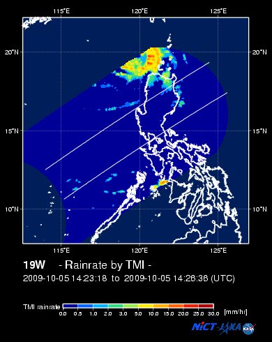
EORC-JAXA TRMM Viewer: Real-Time Rainrate Image
NASA-JAXA TMI Viewer: Latest Rainrate Image
Zoomed Satellite Pic: Near Real-Time
Wunderground Animation: 6-12 hr. GIF Loop
PHILIPPINE STORM SIGNAL # THREE (3)
Now In Effect: ILOCOS NORTE, NORTHERN CAGAYAN, BABUYAN & CALAYAN ISLAND GROUP, & APAYAO.
PHILIPPINE STORM WARNING SIGNAL # TWO (2)
Now In Effect: REST OF CAGAYAN, ILOCOS SUR, ABRA, BATANES GROUP, & KALINGA.
The above areas will experience stormy weather today (with winds not exceeding 100 kph for #02 and more than 100 kph for #03). Coastal waters will be rough to very rough and extremely dangerous to all types of seacrafts.
PHILIPPINE STORM WARNING SIGNAL # ONE (1)
Now In Effect: LA UNION, PANGASINAN, BENGUET, MOUNTAIN PROVINCE, IFUGAO, & ISABELA.
The above areas will have rains and winds of not more than 60 kph today. Coastal waters will be moderate to rough.
Residents living in low-lying and mountainous areas under Public Storm Warning Signal Numbers 3, 2 & 1 are alerted against flashfloods, mudflows, mudslides and landslides.
JTWC (US NAVY/AIR FORCE) 12, 24, 48 & 72 HR. FORECAST & REMARKS:
8 PM (12 GMT) 06 OCTOBER: 18.8N 120.4E / 100-130 KPH (TS) / S @ 02 KPH
<<<Typhoon2000.
Get the latest 6-hrly SMS Storm Alerts on PEPENG!
For more details: Text T2K TYPHOON to
2800 (Globe/TM) | 216 (Smart/TNT) | 2288 (Sun)
*only P2.50 (Smart/Globe) / P2.00 (Sun) per msg received.
powered by: Synermaxx
Typhoon2000 (T2K) NEWS (Mon October 05 2009):
Currently issuing 6-hrly advisories (except 12:00 AM) on TS PARMA (PEPENG).
PARMA (PEPENG) MAX WIND SPEED PER AGENCY:
+ Korea (KMA/10-min avg): 120 km/hr
+ Japan (JMA/10-min avg): 110 km/hr
+ Hong Kong (HKO/10-min avg): 110 km/hr
+ Philippines (PAGASA/10-min avg): 105 km/hr
+ Beijing (NMC/2-min avg): 105 kph
+ Taiwan (CWB/10-min avg): 100 km/hr
+ USA (JTWC/1-min avg): 100 km/hr
TROPICAL STORM PARMA [PEPENG/19W/
T2K PUBLIC ADVISORY NUMBER 025
12:00 PM PST (04:00 GMT) Tue 06 October 2009
Source: T2K ANALYSIS / JTWC WARNING #034
View: Advisory Archives (2004-2009)
*Residents and visitors along Northern Luzon & Southern China should closely monitor the progress of PARMA.
*Kindly refer to your local warnings & bulletins issued by your country's official weather agency. This advisory is intended for additional information purposes only.
+ Forecast Outlook: PARMA is expected to continue drifting south slowly towards the coast of Ilocos Norte for the next 2 to 3 days. The 3 to 5-day Long-Range Forecast shows PARMA turning WSW to westward across the South China Sea on Friday Oct 9. Stormy weather expected across portions of NW Luzon particularly Ilocos provinces down to La Union, Pangasinan and Zambales. *Alternate Forecast Scenario: There are some models showing PARMA making landfall along Ilocos Norte and Ilocos Sur, traversing La Union and Benguet before heading west across Pangasinan between tonight until Thursday, Oct 8. This scenario cannot be ruled out at this time.
+ Effects: PARMA's main circulation remains slightly organized with its core reforming just off the coast of Ilocos Norte...Stormy conditions w/ winds not exceeding 130 kph can be expected along Ilocos Provinces and the rest of Extreme Northern Luzon...while its inner (rain) bands are now spreading across other parts of Northern Luzon - where deteriorating weather conditions w/ winds not exceeding 85 kph can be expected today. Northern parts of Central Luzon will be under PARMA's outer (feeder) bands), where cloudy skies, light to moderate rains w/ winds not exceeding 60 kph can be expected. 1-day rainfall accumulations of 50 up to 100 mm (moderate to heavy rain) can be expected along PARMA's rainbands...
(1) Typhoon MELOR (QUEDAN) beginning to recurve towards Southern Japan...expected to exit PAR later tonight. Click here to view latest T2K advisory.
Kindly click the cool T2K Graphical Satellite Analysis, issued every afternoon, and shows various tropical systems roaming across the South China Sea and the Western Pacific Ocean.
[Important Note: Please keep in mind that the above forecast outlook, effects, current monsoon intensity, & tropical cyclone watch changes every 6 to 12 hrs!]
Time/Date: 12:00 PM PST Tue October 06 2009
Location of Center: 19.2º N Lat 120.3º E Lon
Distance 1: 115 km (63 nm) NNW of Laoag City
Distance 2: 125 km (67 nm) West of Calayan Is.
Distance 3: 180 km (97 nm) North of Vigan City
Distance 4: 230 km (125 nm) SW of Basco, Batanes
Distance 5: 315 km (170 nm) NNW of Baguio City
Distance 6: 355 km (190 nm) North of Dagupan City
Distance 7: 520 km (280 nm) NNW of Metro Manila
MaxWinds (1-min avg): 100 kph (55 kts) near the eye
Peak Wind Gusts: 130 kph (70 kts)
Saffir-Simpson Typhoon Scale: Tropical Storm
Coastal Storm Surge Height: 1-3 feet [0.3-0.9 m]
Minimum Central Pressure: 982 millibars (hPa)
Recent Movement: SSE @ 13 kph (07 kts)
Projected Area of Impact: Ilocos Coastline
Size (in Diameter): 760 km (410 nm) / Large
Max Sea Wave Height (near center): 31 ft (9.4 m)
T2K TrackMap #012 (for Public): 12 PM PST Tue Oct 06
JTWC Ship Avoidance TrackMap: 8 AM Tue Oct 6
Multi-Agency Forecast TrackMap: 11 AM Tue Oct 6
TSR Wind Probabilities: Current to 5-days Ahead
EORC-JAXA TRMM Viewer: Real-Time Rainrate Image
NASA-JAXA TMI Viewer: Latest Rainrate Image
Zoomed Satellite Pic: Near Real-Time
Wunderground Animation: 6-12 hr. GIF Loop
PHILIPPINE STORM SIGNAL # THREE (3)
Now In Effect: ILOCOS NORTE, NORTHERN CAGAYAN, BABUYAN & CALAYAN ISLAND GROUP, & APAYAO.
PHILIPPINE STORM WARNING SIGNAL # TWO (2)
Now In Effect: REST OF CAGAYAN, ILOCOS SUR, ABRA, BATANES GROUP, & KALINGA.
The above areas will experience stormy weather today (with winds not exceeding 100 kph for #02 and more than 100 kph for #03). Coastal waters will be rough to very rough and extremely dangerous to all types of seacrafts.
PHILIPPINE STORM WARNING SIGNAL # ONE (1)
Now In Effect: LA UNION, PANGASINAN, BENGUET, MOUNTAIN PROVINCE, IFUGAO, & ISABELA.
The above areas will have rains and winds of not more than 60 kph today. Coastal waters will be moderate to rough.
Residents living in low-lying and mountainous areas under Public Storm Warning Signal Numbers 3, 2 & 1 are alerted against flashfloods, mudflows, mudslides and landslides.
8 PM (12 GMT) 06 OCTOBER: 18.8N 120.4E / 100-130 KPH (TS) / S @ 02 KPH
8 AM (00 GMT) 07 OCTOBER: 18.5N 120.4E / 100-130 KPH (TS) / SSW @ 04 KPH
8 AM (00 GMT) 08 OCTOBER: 18.0N 120.1E / 100-130 KPH (TS) / SW @ 04 KPH
8 AM (00 GMT) 09 OCTOBER: 17.8N 119.4E / 100-130 KPH (TS) / W @ 04 KPH
8 AM (00 GMT) 08 OCTOBER: 18.0N 120.1E / 100-130 KPH (TS) / SW @ 04 KPH
8 AM (00 GMT) 09 OCTOBER: 17.8N 119.4E / 100-130 KPH (TS) / W @ 04 KPH
REMARKS: 8 AM (00 GMT) 06 OCTOBER POSITION: 19.3N 120.2E.
*TROPICAL STORM (TS) 19W (PARMA) HAS MAINTAINED ITS STRONG TS
INTENSITY WHILE SLOWLY TRACKING SOUTHWARD IN THE LUZON STRAIT.
ANIMATED WATER VAPOR IMAGERY SHOWS THE SYSTEM HAS SUSTAINED GOOD
POLEWARD OUTFLOW WITH CONVECTIVE BANDS MOSTLY ON THE NORTHERN FLANK OF
THE STORM. UPPER LEVEL ANALYSIS INDICATES THE SYSTEM IS LODGED IN A
COL REGION BETWEEN TWO MID-LEVEL RIDGES TO THE WEST AND NORTHEAST IN
A REGION OF LOW TO MODERATE VERTICAL WIND SHEAR. THIS ACCOUNTS FOR THE
STORM'S WEAK STEERING ENVIRONMENT.
>> PARMA, meaning: Macanese food (ham with chicken livers and mushrooms). Name contributed by: Macau, China.
____________
PAGASA CURRENT POSITION, MOVEMENT AND INTENSITY (10-min. ave.):
> 10 AM (02 GMT) 06 OCTOBER: 14.0N 127.0E / WNW @ 19 kph / 195 kph
:: For the complete PAGASA bulletin, kindly visit their website at:
http://www.pagasa.dost.gov.ph/wb/tcupdate.shtml
:: For the complete PAGASA bulletin, kindly visit their website at:
http://www.pagasa.
_______________________________________________________________________________________________________________________________________
RECENT T2K TRACKING CHART:

________________________
RECENT MTSAT-1R SATELLITE IMAGE:

> Image source: NOAA SATELLITE CENTER
RECENT WUNDERGROUND SATELLITE ANIMATION:

> Image source: Wunderground.com (http://www.wunderground.com/ ) ____________________________________________________________________________________________________________________
> Image source: NOAA SATELLITE CENTER
____________________________________________________________________________________________________________________
RECENT WUNDERGROUND SATELLITE ANIMATION:
> Image source: Wunderground.
NOTE:
^ - JTWC commentary remarks (for Meteorologists) from their latest warning.
__________________________________________________________________________________________
>> To know the meteorological terminologies and acronyms used on this update visit the ff:
http://typhoon2000.ph/tcterm.htm
http://www.nhc.noaa.gov/aboutgloss.shtml
http://www.srh.noaa.gov/oun/severewx/glossary.php
http://www.srh.weather.gov/fwd/glossarynation.html
http://www.nhc.noaa.gov/acronyms.shtml
__________________________________________________________________________________________
For the complete details on TS PARMA (PEPENG)...go visit our website @:
> http://www.typhoon2000.com
> http://www.maybagyo.com
>> To know the meteorological terminologies and acronyms used on this update visit the ff:
http://typhoon2000.
http://www.nhc.
http://www.srh.
http://www.srh.
http://www.nhc.
____________
> http://www.typhoon2
> http://www.maybagyo
Copyright © 2009 Typhoon2000.
__._,_.___
MARKETPLACE
Change settings via the Web (Yahoo! ID required)
Change settings via email: Switch delivery to Daily Digest | Switch format to Traditional
Visit Your Group | Yahoo! Groups Terms of Use | Unsubscribe
.
__,_._,___

No comments:
Post a Comment