
for Thursday, 08 October 2009 [6:13 PM PST]


<<<Typhoon2000.com Mobile >>>
Get the latest 6-hrly SMS Storm Alerts on PEPENG!
For more details: Text T2K TYPHOON to
2800 (Globe/TM) | 216 (Smart/TNT) | 2288 (Sun)
*only P2.50 (Smart/Globe) / P2.00 (Sun) per msg received.
powered by: Synermaxx
Typhoon2000 (T2K) NEWS (Tue October 06 2009):
Currently issuing 6-hrly SMS, web & e-mail advisories (except 12:00 AM) on TD PARMA (PEPENG).
PARMA (PEPENG) MAX WIND SPEED PER AGENCY:
+ Beijing (NMC/2-min avg): 65 kph
+ Taiwan (CWB/10-min avg): 65 km/hr
+ Korea (KMA/10-min avg): 65 km/hr
+ Japan (JMA/10-min avg): 65 km/hr
+ Hong Kong (HKO/10-min avg): 55 km/hr
+ USA (JTWC/1-min avg): 55 km/hr
+ Philippines (PAGASA/10-min avg): 55 km/hr
TROPICAL DEPRESSION PARMA [PEPENG/19W/0917]
T2K PUBLIC ADVISORY NUMBER 030
6:00 PM PST (10:00 GMT) Thu 08 October 2009
Source: T2K ANALYSIS / JTWC TC FIX
View: Advisory Archives (2004-2009)
Tropical Depression PARMA (PEPENG) has tracked southwestward during the past 3 hours...now over the city of Santiago in Isabela...Thick rainbands covering the whole of Luzon including Metro Manila and portions of Bicol Peninsula.
*Residents and visitors along Western Luzon should closely monitor the progress of PARMA.
*Kindly refer to your local warnings & bulletins issued by your country's official weather agency. This advisory is intended for additional information purposes only.
+ Forecast Outlook: PARMA is expected to turn more westward within the next 24 hours and crossing Nueva Vizcaya-Ifugao-Benguet overnight...early tomorrow, PARMA shall be passing across La Union or Northern Pangasinan. It shall weaken to just minimal TD strength until it reaches the South China Sea, where re-strengthening will happen again. The 2 to 5-day Long-Range Forecast shows PARMA accelerating West to WNW across the warm South China Sea and shall regain back TS status. PARMA is forecast to make landfall over Hainan Island on Tuesday Oct 13, with forecast wind velocity of 75 kph.
+ Effects: PARMA's slightly organized circulation has strengthened and is currently covering the whole of Luzon...dumping excessive amounts of rainfall from Aparri down to Metro Manila. Possible flooding is likely...its outer bands has been expanding southward - bringing windy conditions (of up to 40 kph) w/ occasional light rains across Central & Southern Luzon including Bicol Peninsula. 1-day rainfall accumulations of 100 up to 200 mm (moderate to heavy rain) can be expected along PARMA's rainbands...with isolated accumulations of up to 400 mm (very heavy to extreme rain) near the center of PARMA or along mountains slopes particularly along its path. Residents in low-lying areas & steep slopes must remain alert & seek evacuation for possible life-threatening flash floods, mudslides & landslides due to the anticipated heavy rains brought about by this system. Precautionary measures must be initiated if necessary.
+ Tropical Cyclone Watch:
(1) Extratropical Storm MELOR (QUEDAN) just exit west of Honshu...now heading towards the seas south of Kuril Islands. Click here to view the final T2K advisory.
(2) Strong Tropical Disturbance 92W [LPA] may become a TD tonight. Watch for more information on this disturbance as new data arrives. Kindly click the cool T2K Graphical Satellite Analysis, issued every afternoon, and shows various tropical systems roaming across the South China Sea and the Western Pacific Ocean.
[Important Note: Please keep in mind that the above forecast outlook, effects, current monsoon intensity, & tropical cyclone watch changes every 6 to 12 hrs!]
Time/Date: 6:00 PM PST Thu October 08 2009
Location of Center: 16.6º N Lat 121.5º E Lon
Distance 1: 40 km (23 nm) SSW of Cauayan, Isabela
Distance 2: 80 km (43 nm) NW of Casiguran, Aurora
Distance 3: 100 km (55 nm) ENE of Baguio City
Distance 4: 130 km (70 nm) East of San Fernando City
Distance 5: 135 km (73 nm) NNE of Cabanatuan City
Distance 6: 140 km (75 nm) NE of Dagupan City
Distance 7: 225 km (123 nm) NNE of Metro Manila
MaxWinds (1-min avg): 55 kph (30 kts) near the center
Peak Wind Gusts: 75 kph (40 kts)
Saffir-Simpson Typhoon Scale: Tropical Depression
Coastal Storm Surge Height: 0 feet [0 m]
Minimum Central Pressure: 1000 millibars (hPa)
Recent Movement: SW @ 05 kph (03 kts)
Projected Area of Impact: Nueva Vizcaya-Ifugao-Benguet
Size (in Diameter): 665 km (360 nm) / Avg/Large
Max Sea Wave Height (near center): 12 ft (3.6 m)
T2K TrackMap #018 (for Public): 6 PM PST Thu Oct 08
JTWC Ship Avoidance TrackMap: 2 PM Thu Oct 8
Multi-Agency Forecast TrackMap: 5 PM Thu Oct 8
TSR Wind Probabilities: Current to 5-days Ahead
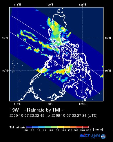
EORC-JAXA TRMM Viewer: Real-Time Rainrate Image
NASA-JAXA TMI Viewer: Latest Rainrate Image
Zoomed Satellite Pic: Near Real-Time
Wunderground Animation: 6-12 hr. GIF Loop
PHILIPPINE STORM WARNING SIGNAL # ONE (1)
Now In Effect: BATANES, CAGAYAN, BABUYAN, CALAYAN, ISABELA, ILOCOS PROVINCES, APAYAO, ABRA, KALINGA, IFUGAO, MOUNTAIN PROVINCE, BENGUET, LA UNION, PANGASINAN, NUEVA VIZCAYA, QUIRINO, AURORA, NUEVA ECIJA, TARLAC, PAMPANGA, ZAMBALES, BATAAN & BULACAN.
The above areas will have rains and winds of not more than 60 kph tonight and tomorrow. Coastal waters will be moderate to rough.
Residents living in low-lying and mountainous areas under Public Storm Warning Signal Number 1 are alerted against flashfloods, mudflows, mudslides and landslides.
JTWC (US NAVY/AIR FORCE) 12, 24, 48 & 72 HR. FORECAST & REMARKS:
2 AM (18 GMT) 09 OCTOBER: 17.3N 121.0E / 45-65 KPH (TD) / W @ 07 KPH
<<<Typhoon2000.
Get the latest 6-hrly SMS Storm Alerts on PEPENG!
For more details: Text T2K TYPHOON to
2800 (Globe/TM) | 216 (Smart/TNT) | 2288 (Sun)
*only P2.50 (Smart/Globe) / P2.00 (Sun) per msg received.
powered by: Synermaxx
Typhoon2000 (T2K) NEWS (Tue October 06 2009):
Currently issuing 6-hrly SMS, web & e-mail advisories (except 12:00 AM) on TD PARMA (PEPENG).
PARMA (PEPENG) MAX WIND SPEED PER AGENCY:
+ Beijing (NMC/2-min avg): 65 kph
+ Taiwan (CWB/10-min avg): 65 km/hr
+ Korea (KMA/10-min avg): 65 km/hr
+ Japan (JMA/10-min avg): 65 km/hr
+ Hong Kong (HKO/10-min avg): 55 km/hr
+ USA (JTWC/1-min avg): 55 km/hr
+ Philippines (PAGASA/10-min avg): 55 km/hr
TROPICAL DEPRESSION PARMA [PEPENG/19W/
T2K PUBLIC ADVISORY NUMBER 030
6:00 PM PST (10:00 GMT) Thu 08 October 2009
Source: T2K ANALYSIS / JTWC TC FIX
View: Advisory Archives (2004-2009)
*Residents and visitors along Western Luzon should closely monitor the progress of PARMA.
*Kindly refer to your local warnings & bulletins issued by your country's official weather agency. This advisory is intended for additional information purposes only.
+ Forecast Outlook: PARMA is expected to turn more westward within the next 24 hours and crossing Nueva Vizcaya-Ifugao-
(1) Extratropical Storm MELOR (QUEDAN) just exit west of Honshu...now heading towards the seas south of Kuril Islands. Click here to view the final T2K advisory.
(2) Strong Tropical Disturbance 92W [LPA] may become a TD tonight. Watch for more information on this disturbance as new data arrives. Kindly click the cool T2K Graphical Satellite Analysis, issued every afternoon, and shows various tropical systems roaming across the South China Sea and the Western Pacific Ocean.
[Important Note: Please keep in mind that the above forecast outlook, effects, current monsoon intensity, & tropical cyclone watch changes every 6 to 12 hrs!]
Time/Date: 6:00 PM PST Thu October 08 2009
Location of Center: 16.6º N Lat 121.5º E Lon
Distance 1: 40 km (23 nm) SSW of Cauayan, Isabela
Distance 2: 80 km (43 nm) NW of Casiguran, Aurora
Distance 3: 100 km (55 nm) ENE of Baguio City
Distance 4: 130 km (70 nm) East of San Fernando City
Distance 5: 135 km (73 nm) NNE of Cabanatuan City
Distance 6: 140 km (75 nm) NE of Dagupan City
Distance 7: 225 km (123 nm) NNE of Metro Manila
MaxWinds (1-min avg): 55 kph (30 kts) near the center
Peak Wind Gusts: 75 kph (40 kts)
Saffir-Simpson Typhoon Scale: Tropical Depression
Coastal Storm Surge Height: 0 feet [0 m]
Minimum Central Pressure: 1000 millibars (hPa)
Recent Movement: SW @ 05 kph (03 kts)
Projected Area of Impact: Nueva Vizcaya-Ifugao-
Size (in Diameter): 665 km (360 nm) / Avg/Large
Max Sea Wave Height (near center): 12 ft (3.6 m)
T2K TrackMap #018 (for Public): 6 PM PST Thu Oct 08
JTWC Ship Avoidance TrackMap: 2 PM Thu Oct 8
Multi-Agency Forecast TrackMap: 5 PM Thu Oct 8
TSR Wind Probabilities: Current to 5-days Ahead
EORC-JAXA TRMM Viewer: Real-Time Rainrate Image
NASA-JAXA TMI Viewer: Latest Rainrate Image
Zoomed Satellite Pic: Near Real-Time
Wunderground Animation: 6-12 hr. GIF Loop
PHILIPPINE STORM WARNING SIGNAL # ONE (1)
Now In Effect: BATANES, CAGAYAN, BABUYAN, CALAYAN, ISABELA, ILOCOS PROVINCES, APAYAO, ABRA, KALINGA, IFUGAO, MOUNTAIN PROVINCE, BENGUET, LA UNION, PANGASINAN, NUEVA VIZCAYA, QUIRINO, AURORA, NUEVA ECIJA, TARLAC, PAMPANGA, ZAMBALES, BATAAN & BULACAN.
The above areas will have rains and winds of not more than 60 kph tonight and tomorrow. Coastal waters will be moderate to rough.
Residents living in low-lying and mountainous areas under Public Storm Warning Signal Number 1 are alerted against flashfloods, mudflows, mudslides and landslides.
2 AM (18 GMT) 09 OCTOBER: 17.3N 121.0E / 45-65 KPH (TD) / W @ 07 KPH
2 PM (06 GMT) 09 OCTOBER: 17.3N 120.2E / 45-65 KPH (TD) / WNW @ 07 KPH
2 PM (06 GMT) 10 OCTOBER: 17.9N 118.5E / 55-75 KPH (TD) / W @ 13 KPH
2 PM (06 GMT) 11 OCTOBER: 18.5N 115.5E / 65-85 KPH (TS) / W @ 17 KPH
2 PM (06 GMT) 10 OCTOBER: 17.9N 118.5E / 55-75 KPH (TD) / W @ 13 KPH
2 PM (06 GMT) 11 OCTOBER: 18.5N 115.5E / 65-85 KPH (TS) / W @ 17 KPH
REMARKS: 2 PM (06 GMT) 08 OCTOBER POSITION: 17.2N 121.7E.
*ANIMATED MULTISPECTRAL IMAGERY HAS SHOWN LITTLE CHANGE OVER THE PAST 06 HOURS.
CONVECTIVE BANDS ARE STILL WRAPPING TOWARDS THE LOW LEVEL CIRCULATION
CENTER (LLCC). PARMA REMAINS QUASI-STATIONARY OVER LUZON BUT IS
FORECAST TO INCREASE ITS TRACK SPEED AS LOW- TO MID-LEVEL RIDGING
DEVELOPS TO THE NORTH OF PARMA OUT OF CENTRAL CHINA AND OVER TO
TAIWAN. THE UPPER LEVEL ENVIRONMENT REMAINS FAVORABLE WITH A POINT
SOURCE ANTI-CYCLONE LOCATED OVER THE LLCC. AS PARMA MOVES OVER WATER
AGAIN, DEVELOPMENT IS EXPECTED BUT DUE TO INCREASED VERTICAL WIND
SHEAR AND AN ACCELERATED TRACK SPEED IN THE LATER TAUS, THE POTENTIAL
FOR SIGNIFICANT DEVELOPMENT WILL BE HINDERED...(more)
>> PARMA, meaning: Macanese food (ham with chicken livers and mushrooms). Name contributed by: Macau, China.
____________
PAGASA CURRENT POSITION, MOVEMENT AND INTENSITY (10-min. ave.):
> 4 PM (08 GMT) 08 OCTOBER: 17.0N 121.7E / West Slowly / 55 kph
:: For the complete PAGASA bulletin, kindly visit their website at:
http://www.pagasa.dost.gov.ph/wb/tcupdate.shtml
:: For the complete PAGASA bulletin, kindly visit their website at:
http://www.pagasa.
_______________________________________________________________________________________________________________________________________
RECENT T2K TRACKING CHART:

________________________
RECENT MTSAT-1R SATELLITE IMAGE:

> Image source: NOAA SATELLITE CENTER
RECENT WUNDERGROUND SATELLITE ANIMATION:

> Image source: Wunderground.com (http://www.wunderground.com/ ) ____________________________________________________________________________________________________________________
> Image source: NOAA SATELLITE CENTER
____________________________________________________________________________________________________________________
RECENT WUNDERGROUND SATELLITE ANIMATION:
> Image source: Wunderground.
NOTE:
^ - JTWC commentary remarks (for Meteorologists) from their latest warning.
__________________________________________________________________________________________
>> To know the meteorological terminologies and acronyms used on this update visit the ff:
http://typhoon2000.ph/tcterm.htm
http://www.nhc.noaa.gov/aboutgloss.shtml
http://www.srh.noaa.gov/oun/severewx/glossary.php
http://www.srh.weather.gov/fwd/glossarynation.html
http://www.nhc.noaa.gov/acronyms.shtml
__________________________________________________________________________________________
For the complete details on TD PARMA (PEPENG)...go visit our website @:
> http://www.typhoon2000.com
> http://www.maybagyo.com
>> To know the meteorological terminologies and acronyms used on this update visit the ff:
http://typhoon2000.
http://www.nhc.
http://www.srh.
http://www.srh.
http://www.nhc.
____________
> http://www.typhoon2
> http://www.maybagyo
Copyright © 2009 Typhoon2000.
__._,_.___
Change settings via the Web (Yahoo! ID required)
Change settings via email: Switch delivery to Daily Digest | Switch format to Traditional
Visit Your Group | Yahoo! Groups Terms of Use | Unsubscribe
.
__,_._,___

No comments:
Post a Comment