
for Wednesday, 30 September 2009 [5:42 PM PST]


<<<Typhoon2000.com Mobile >>>
Get the latest SMS Storm Alerts on PEPENG!
For more details: Text T2K TYPHOON to
2800 (Globe/TM) | 216 (Smart/TNT) | 2288 (Sun)
*only P2.50 (Smart/Globe) / P2.00 (Sun) per msg received.
powered by: Synermaxx
Typhoon2000 (T2K) NEWS (Wed September 30 2009):
Currently issuing 6-hrly advisories (except 12:00 AM) on Typhoon PARMA (PEPENG).
PARMA (PEPENG) MAX WIND SPEED PER AGENCY:
+ USA (JTWC/1-min avg): 140 km/hr
+ Japan (JMA/10-min avg): 130 km/hr
+ Korea (KMA/10-min avg): 130 km/hr
+ Taiwan (CWB/10-min avg): 120 km/hr
+ Beijing (NMC/2-min avg): 120 km/hr
+ Philippines (PAGASA/10-min avg): 120 km/hr
TYPHOON PARMA [PEPENG/19W/0917]
T2K PUBLIC ADVISORY NUMBER 009
6:00 PM PST (10:00 GMT) Wed 30 September 2009
Source: T2K ANALYSIS / JTWC WARNING #011
View: Advisory Archives (2004-2009)
Typhoon PARMA (PEPENG) is now well within the Philippine Area of Responsibility (PAR)...strengthening as it threatens Luzon, Philippines.
*Residents and visitors along the east coast of Luzon, Philippines should closely monitor the progress of PARMA.
*Kindly refer to your local warnings & bulletins issued by your country's official weather agency. This advisory is intended for additional information purposes only.
+ Forecast Outlook: PARMA is expected to maintain its WNW track across the warm Philippine Sea. The 2 to 5-day Long-Range Forecast shows the system at its closest point of approach (CPA) to Bicol Region - about 385 km. NE of Metro Naga/CWC on Friday afternoon, with Category 3 strength of 185 kph near the eye...and shall move closer to the coast of Cagayan with a distance of only 120 km. NE of the northeastern tip of Luzon. PARMA shall be very close to the Batanes Islands...about 75 km. to the east of Basco on Monday morning, Oct 5 - with Category 4 strength of 215 kph near the eye. Please be aware that long-range forecast changes every now and then. Continued monitoring on this potential typhoon is a must for disaster preparedness agencies.
+ Effects: PARMA's circulation is slowly growing in size as it moves across the Philippine Sea...now an average tropical cyclone. Its inner (rain) bands has left the islands of Yap & Ulithi with only the eastern outer bands affecting the islands. Meanwhile, its outer (feeder) bands still spreading across Palau Island and extends west across Eastern and Southern Mindanao - passing rains, squalls, thunderstorms w/ gale-force winds may be expected along these bands. 1-day rainfall accumulations of 100 up to 200 mm (moderate to heavy rain) can be expected along PARMA's rainbands...with isolated accumulations of up to 400 mm (very heavy rain) near the center of PARMA.
+ Tropical Cyclone Watch:
(1) Tropical Depression 18W (UNNAMED) located ENE of TY PARMA, has started dissipating after passing close to Guam. Click here to view the final T2K advisory.
(2) Tropical Storm MELOR (20W) continues to gain strength as it moves towards the Marianas. Click here to view latest T2K advisory.
Kindly click the cool T2K Graphical Satellite Analysis, issued every afternoon, and shows various tropical systems roaming across the South China Sea and the Western Pacific Ocean.
[Important Note: Please keep in mind that the above forecast outlook, effects, current monsoon intensity, & tropical cyclone watch changes every 6 to 12 hrs!]
Time/Date: 6:00 PM PST Wed September 30 2009
Location of Eye: 10.4º N Lat 134.5º E Lon
Distance 1: 985 km (532 nm) ENE of Surigao City
Distance 2: 1,000 km (540 nm) ESE of Borongan, E.Samar
Distance 3: 1,165 km (630 nm) ESE of Virac, Catanduanes
Distance 4: 1,180 km (638 nm) ESE of Sorsogon City
Distance 5: 1,215 km (655 nm) ESE of Legazpi City
Distance 6: 1,225 km (660 nm) ESE of Gota Beach Resort
Distance 7: 1,280 km (692 nm) ESE of Metro Naga/CWC
Distance 8: 1,525 km (825 nm) ESE of Metro Manila
MaxWinds (1-min avg): 140 kph (75 kts) near the eye
Peak Wind Gusts: 165 kph (90 kts)
Saffir-Simpson Typhoon Scale: Category 1
Coastal Storm Surge Height: 4-5 feet [1.2-1.7 m]
Minimum Central Pressure: 967 millibars (hPa)
Recent Movement: WNW @ 28 kph (15 kts)
Projected Path (Impact): Philippine Sea-Taiwan Area
Size (in Diameter): 370 km (200 nm) / Average
Max Sea Wave Height (near center): 22 ft (6.7 m)
NWS-Guam TrackMap (for Public): 5 PM PST Wed Sep 30
JTWC Ship Avoidance TrackMap: 06 GMT Wed Sep 30
Multi-Agency Forecast TrackMap: 2 PM Wed Sep 30
TSR Wind Probabilities: Current to 5-days Ahead
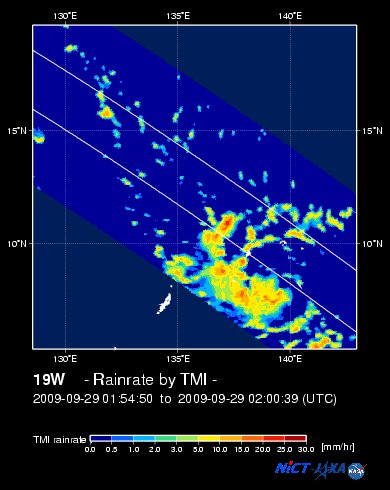
EORC-JAXA TRMM Viewer: Real-Time Rainrate Image new!
NASA-JAXA TMI Viewer: Latest Rainrate Image new!
Zoomed Satellite Pic: Near Real-Time
Wunderground Animation: 6-12 hr. GIF Loop
JTWC (US NAVY/AIR FORCE) 12, 24, 48 & 72 HR. FORECAST & REMARKS:
2 AM (18 GMT) 30 SEPTEMBER: 11.5N 132.8E / 160-195 KPH (TY-Cat 2) / WNW @ 26 KPH
<<<Typhoon2000.
Get the latest SMS Storm Alerts on PEPENG!
For more details: Text T2K TYPHOON to
2800 (Globe/TM) | 216 (Smart/TNT) | 2288 (Sun)
*only P2.50 (Smart/Globe) / P2.00 (Sun) per msg received.
powered by: Synermaxx
Typhoon2000 (T2K) NEWS (Wed September 30 2009):
Currently issuing 6-hrly advisories (except 12:00 AM) on Typhoon PARMA (PEPENG).
PARMA (PEPENG) MAX WIND SPEED PER AGENCY:
+ USA (JTWC/1-min avg): 140 km/hr
+ Japan (JMA/10-min avg): 130 km/hr
+ Korea (KMA/10-min avg): 130 km/hr
+ Taiwan (CWB/10-min avg): 120 km/hr
+ Beijing (NMC/2-min avg): 120 km/hr
+ Philippines (PAGASA/10-min avg): 120 km/hr
TYPHOON PARMA [PEPENG/19W/
T2K PUBLIC ADVISORY NUMBER 009
6:00 PM PST (10:00 GMT) Wed 30 September 2009
Source: T2K ANALYSIS / JTWC WARNING #011
View: Advisory Archives (2004-2009)
*Residents and visitors along the east coast of Luzon, Philippines should closely monitor the progress of PARMA.
*Kindly refer to your local warnings & bulletins issued by your country's official weather agency. This advisory is intended for additional information purposes only.
+ Forecast Outlook: PARMA is expected to maintain its WNW track across the warm Philippine Sea. The 2 to 5-day Long-Range Forecast shows the system at its closest point of approach (CPA) to Bicol Region - about 385 km. NE of Metro Naga/CWC on Friday afternoon, with Category 3 strength of 185 kph near the eye...and shall move closer to the coast of Cagayan with a distance of only 120 km. NE of the northeastern tip of Luzon. PARMA shall be very close to the Batanes Islands...about 75 km. to the east of Basco on Monday morning, Oct 5 - with Category 4 strength of 215 kph near the eye. Please be aware that long-range forecast changes every now and then. Continued monitoring on this potential typhoon is a must for disaster preparedness agencies.
+ Effects: PARMA's circulation is slowly growing in size as it moves across the Philippine Sea...now an average tropical cyclone. Its inner (rain) bands has left the islands of Yap & Ulithi with only the eastern outer bands affecting the islands. Meanwhile, its outer (feeder) bands still spreading across Palau Island and extends west across Eastern and Southern Mindanao - passing rains, squalls, thunderstorms w/ gale-force winds may be expected along these bands. 1-day rainfall accumulations of 100 up to 200 mm (moderate to heavy rain) can be expected along PARMA's rainbands...
(1) Tropical Depression 18W (UNNAMED) located ENE of TY PARMA, has started dissipating after passing close to Guam. Click here to view the final T2K advisory.
(2) Tropical Storm MELOR (20W) continues to gain strength as it moves towards the Marianas. Click here to view latest T2K advisory.
Kindly click the cool T2K Graphical Satellite Analysis, issued every afternoon, and shows various tropical systems roaming across the South China Sea and the Western Pacific Ocean.
[Important Note: Please keep in mind that the above forecast outlook, effects, current monsoon intensity, & tropical cyclone watch changes every 6 to 12 hrs!]
Time/Date: 6:00 PM PST Wed September 30 2009
Location of Eye: 10.4º N Lat 134.5º E Lon
Distance 1: 985 km (532 nm) ENE of Surigao City
Distance 2: 1,000 km (540 nm) ESE of Borongan, E.Samar
Distance 3: 1,165 km (630 nm) ESE of Virac, Catanduanes
Distance 4: 1,180 km (638 nm) ESE of Sorsogon City
Distance 5: 1,215 km (655 nm) ESE of Legazpi City
Distance 6: 1,225 km (660 nm) ESE of Gota Beach Resort
Distance 7: 1,280 km (692 nm) ESE of Metro Naga/CWC
Distance 8: 1,525 km (825 nm) ESE of Metro Manila
MaxWinds (1-min avg): 140 kph (75 kts) near the eye
Peak Wind Gusts: 165 kph (90 kts)
Saffir-Simpson Typhoon Scale: Category 1
Coastal Storm Surge Height: 4-5 feet [1.2-1.7 m]
Minimum Central Pressure: 967 millibars (hPa)
Recent Movement: WNW @ 28 kph (15 kts)
Projected Path (Impact): Philippine Sea-Taiwan Area
Size (in Diameter): 370 km (200 nm) / Average
Max Sea Wave Height (near center): 22 ft (6.7 m)
NWS-Guam TrackMap (for Public): 5 PM PST Wed Sep 30
JTWC Ship Avoidance TrackMap: 06 GMT Wed Sep 30
Multi-Agency Forecast TrackMap: 2 PM Wed Sep 30
TSR Wind Probabilities: Current to 5-days Ahead
EORC-JAXA TRMM Viewer: Real-Time Rainrate Image new!
NASA-JAXA TMI Viewer: Latest Rainrate Image new!
Zoomed Satellite Pic: Near Real-Time
Wunderground Animation: 6-12 hr. GIF Loop
2 AM (18 GMT) 30 SEPTEMBER: 11.5N 132.8E / 160-195 KPH (TY-Cat 2) / WNW @ 26 KPH
2 PM (06 GMT) 01 OCTOBER: 13.0N 130.3E / 165-205 KPH (TY-Cat 2) / WNW @ 22 KPH
2 PM (06 GMT) 02 OCTOBER: 15.1N 126.4E / 185-230 KPH (TY-Cat 3) / NW @ 15 KPH
2 PM (06 GMT) 03 OCTOBER: 17.4N 124.0E / 195-240 KPH (TY-Cat 3) / NNW @ 09 KPH
2 PM (06 GMT) 02 OCTOBER: 15.1N 126.4E / 185-230 KPH (TY-Cat 3) / NW @ 15 KPH
2 PM (06 GMT) 03 OCTOBER: 17.4N 124.0E / 195-240 KPH (TY-Cat 3) / NNW @ 09 KPH
REMARKS: 2 PM (06 GMT) 30 SEPTEMBER POSITION: 9.9N 135.3E.
*ANIMATED MULTISPECTRAL SATELLITE IMAGERY SHOWS A
WELL DEFINED EYE FEATURE HAS PERSISTED OVER THE PAST 12 HOURS. A
292049Z QUIKSCAT PASS INDICATES THAT TY 19W REMAINS FAIRLY COMPACT,
WHICH IS SUPPORTED BY OBSERVATIONS AT PALAU AND YAP. THE TRACK SPEED
FOR TY 19W HAS INCREASED OVER THE PAST 06 HOURS UNDER THE STEERING
INFLUENCE OF THE LOW- TO MID-LEVEL SUBTROPICAL SYSTEM TO THE
NORTHEAST. UPPER LEVEL ANALYSIS HAS PARMA LOCATED UNDER A REGION OF
STRONG DIVERGENCE ALLOWING FOR A GOOD WESTWARD OUTFLOW CHANNEL TO
PERSIST. DEVELOPMENT WILL CONTINUE THROUGHOUT THE FORECAST PERIOD.
MAXIMUM SIGNIFICANT WAVE HEIGHT AT 300600Z IS 22 FEET...(more)
>> PARMA, meaning: Macanese food (ham with chicken livers and mushrooms). Name contributed by: Macau, China.
____________
PAGASA CURRENT POSITION, MOVEMENT AND INTENSITY (10-min. ave.):
> 4 PM (08 GMT) 30 SEPTEMBER: 10.2N 135.0E / WNW @ 22 kph / 120 kph
:: For the complete PAGASA bulletin, kindly visit their website at:
http://www.pagasa.dost.gov.ph/wb/tcupdate.shtml
_______________________________________________________________________________________________________________________________________
:: For the complete PAGASA bulletin, kindly visit their website at:
http://www.pagasa.
____________
RECENT NWS-GUAM TRACKING CHART:

________________________
RECENT MTSAT-1R SATELLITE IMAGE:

> Image source: NOAA SATELLITE CENTER
RECENT WUNDERGROUND SATELLITE ANIMATION: (EXPERIENCING TECHNICAL PROBLEMS)

> Image source: Wunderground.com (http://www.wunderground.com/ ) ____________________________________________________________________________________________________________________
> Image source: NOAA SATELLITE CENTER
____________________________________________________________________________________________________________________
RECENT WUNDERGROUND SATELLITE ANIMATION: (EXPERIENCING TECHNICAL PROBLEMS)
> Image source: Wunderground.
NOTE:
^ - JTWC commentary remarks (for Meteorologists) from their latest warning.
__________________________________________________________________________________________
>> To know the meteorological terminologies and acronyms used on this update visit the ff:
http://typhoon2000.ph/tcterm.htm
http://www.nhc.noaa.gov/aboutgloss.shtml
http://www.srh.noaa.gov/oun/severewx/glossary.php
http://www.srh.weather.gov/fwd/glossarynation.html
http://www.nhc.noaa.gov/acronyms.shtml
__________________________________________________________________________________________
For the complete details on TY PARMA (PEPENG)...go visit our website @:
> http://www.typhoon2000.com
> http://www.maybagyo.com
>> To know the meteorological terminologies and acronyms used on this update visit the ff:
http://typhoon2000.
http://www.nhc.
http://www.srh.
http://www.srh.
http://www.nhc.
____________
> http://www.typhoon2
> http://www.maybagyo
Copyright © 2009 Typhoon2000.
__._,_.___
Change settings via the Web (Yahoo! ID required)
Change settings via email: Switch delivery to Daily Digest | Switch format to Traditional
Visit Your Group | Yahoo! Groups Terms of Use | Unsubscribe
.
__,_._,___

No comments:
Post a Comment