Typhoon2000 STORM UPDATE #001
Name: TROPICAL STORM 07W [FRANK]
Issued: 7:00 AM MANILA TIME (23:00 GMT) THU 19 JUNE 2008
Source: JTWC TROPICAL CYCLONE WARNING NUMBER 002
Note: Kindly refer to your country's official warnings or bulletins. This update is for additional information purposes only.
Source: JTWC TROPICAL CYCLONE WARNING NUMBER 002
Note: Kindly refer to your country's official warnings or bulletins. This update is for additional information purposes only.
_____________________________________________________________________________
TROPICAL STORM 07W (FRANK) NEWLY-FORMED OVER THE SOUTHERN PHILIPPINE SEA.
THREATENS EASTERN VISAYAS AND BICOL REGION.
+ FORECAST OUTLOOK: 07W is expected to continue tracking WNW to NW'ly
THREATENS EASTERN VISAYAS AND BICOL REGION.
+ FORECAST OUTLOOK: 07W is expected to continue tracking WNW to NW'ly
within the next 24 to 36 hours, becoming a Category 1 Typhoon tomorrow
afternoon (June 20). The 2 to 5-day long-range forecast shows the poten-
tial typhoon turning Northward while about 400 km East of the Bicol Region
on Saturday early morning, June 21 w/ forecast wind speed of 140 km/hr. It
shall then accelerate, recurving towards the NNE to NE across the open
waters of the Philippine Sea, without touching the Eastern Coast of the
Philippines from Sunday until early Tuesday morning (June 22-24).
+ EFFECTS: The outer (rain) bands of 07W is now affecting Surigao and
+ EFFECTS: The outer (rain) bands of 07W is now affecting Surigao and
Northern Mindanao and shall reach Eastern Visayas later today. Widespread
rains & thunderstorms, with winds of up to 40 km/hr can be expected along
these outer bands. Throughout the weekend, these bands may be affecting
the Bicol Region. People living in low-lying areas must seek higher grounds
for possible flooding & landslides due to the anticipated heavy rains
brought about by this system.
Important Note: Please keep in mind that the above forecast outlook,
effects & current monsoon intensity, and tropical cyclone watch changes
every 06 to 12 hours!
_____________________________________________________________________________
TIME/DATE: 5:00 AM MANILA TIME (21:00 GMT) 19 JUNE
LOCATION OF CENTER: LATITUDE 9.8º N...LONGITUDE 131.3º E {Sat Fix}
DISTANCE 1: 635 KM (343 NM) EAST OF SURIGAO CITY, PH
effects & current monsoon intensity, and tropical cyclone watch changes
every 06 to 12 hours!
____________
LOCATION OF CENTER: LATITUDE 9.8º N...LONGITUDE 131.3º E {Sat Fix}
DISTANCE 1: 635 KM (343 NM) EAST OF SURIGAO CITY, PH
DISTANCE 2: 675 KM (365 NM) ESE OF BORONGAN, EASTERN SAMAR, PH
DISTANCE 3: 710 KM (385 NM) ESE OF TACLOBAN CITY, PH
DISTANCE 4: 870 KM (470 NM) SE OF VIRAC, CATANDUANES, PH
DISTANCE 5: 905 KM (488 NM) SE OF LEGAZPI CITY, PH
DISTANCE 6: 980 KM (530 NM) SE OF NAGA CITY, PH
MAX WINDS [1-MIN AVG]: 65 KM/HR (35 KTS) NEAR THE CENTER
PEAK WIND GUSTS: 85 KM/HR (45 KTS)
SAFFIR-SIMPSON SCALE: N/A
MINIMUM CENTRAL PRESSURE (est.): 996 MILLIBARS (hPa)
RECENT MOVEMENT: WNW @ 15 KM/HR (08 KTS)
GENERAL DIRECTION: PHILIPPINE SEA
STORM'S SIZE (IN DIAMETER): 400 KM (215 NM)/AVERAGE
MAX WAVE HEIGHT**: 14 FEET (4.2 METERS)
VIEW TRACKING MAP: 2 AM MANILA TIME THU JUNE 19
TSR WIND PROBABILITIES: CURRENT TO 120 HRS LEAD
PHILIPPINE STORM SIGNALS*: N/A
12, 24, 48 & 72 HR. FORECAST:
2 PM (06 GMT) 19 JUNE: 10.5N 130.6E / 85-100 KPH / NW @ 15 KPH
2 AM (18 GMT) 20 JUNE: 11.6N 129.4E / 100-130 KPH / NW @ 13 KPH
2 AM (18 GMT) 21 JUNE: 14.0N 128.2E / 140-165 KPH / N @ 13 KPH
2 AM (18 GMT) 22 JUNE: 16.8N 128.7E / 150-185 KPH / NE @ 13 KPH
REMARKS: 2 AM (18 GMT) 19 JUNE POSITION: 9.7N 131.9E.
^TROPICAL DEPRESSION (TD) 07W HAS SLOWLY CONSOLIDATED OVER THE PAST
12 HOURS. ANIMATED SATELLITE IMAGERY AND RECENT MICROWAVE IMAGERY
INDICATE IMPROVED DEEP CONVECTIVE BANDING WRAPPING INTO THE LOW-
LEVEL CIRCULATION CENTER (LLCC). A 6 PM JUNE 18 SSMIS IMAGE DEPICTS
CURVED BANDING PRIMARILY OVER THE WESTERN SEMI-CIRCLE WITH AN ELONG-
ATED LLCC. AN 5:01 PM JUNE 18 QUIKSCAT IMAGE REVEALS A WELL-DEFINED
CENTER WITH MULTIPLE UNFLAGGED 25-KNOT WINDS OVER THE EASTERN AND
NORTHERN QUADRANTS SUPPORTING THE UPGRADE TO TD STATUS. UPPER AIR
DATA ALSO SUPPORTED THE UPGRADE WITH OBSERVATIONS INDICATING 20-27
KNOTS IN THE LOWER 1000 FEET WITHIN 120-240 NM OF THE CENTER...
(more).
_____________________________________________________________________________
PAGASA CURRENT POSITION, MOVEMENT AND INTENSITY (10-min. ave.):
RECENT WUNDERGROUND.COM TRACKING CHART :
2 AM (18 GMT) 22 JUNE: 16.8N 128.7E / 150-185 KPH / NE @ 13 KPH
REMARKS: 2 AM (18 GMT) 19 JUNE POSITION: 9.7N 131.9E.
^TROPICAL DEPRESSION (TD) 07W HAS SLOWLY CONSOLIDATED OVER THE PAST
12 HOURS. ANIMATED SATELLITE IMAGERY AND RECENT MICROWAVE IMAGERY
INDICATE IMPROVED DEEP CONVECTIVE BANDING WRAPPING INTO THE LOW-
LEVEL CIRCULATION CENTER (LLCC). A 6 PM JUNE 18 SSMIS IMAGE DEPICTS
CURVED BANDING PRIMARILY OVER THE WESTERN SEMI-CIRCLE WITH AN ELONG-
ATED LLCC. AN 5:01 PM JUNE 18 QUIKSCAT IMAGE REVEALS A WELL-DEFINED
CENTER WITH MULTIPLE UNFLAGGED 25-KNOT WINDS OVER THE EASTERN AND
NORTHERN QUADRANTS SUPPORTING THE UPGRADE TO TD STATUS. UPPER AIR
DATA ALSO SUPPORTED THE UPGRADE WITH OBSERVATIONS INDICATING 20-27
KNOTS IN THE LOWER 1000 FEET WITHIN 120-240 NM OF THE CENTER...
(more).
____________
PAGASA CURRENT POSITION, MOVEMENT AND INTENSITY (10-min. ave.):
> 2 AM (18 GMT) 19 MAY: 9.4N 131.8E / WNW @ 11 KPH / 55 kph
:: For the complete PAGASA bulletin, kindly visit their website at:
http://www.pagasa.dost.gov.ph/wb/tcupdate.shtml
_____________________________________________________________________________
:: For the complete PAGASA bulletin, kindly visit their website at:
http://www.pagasa.
____________
RECENT WUNDERGROUND.
________________________
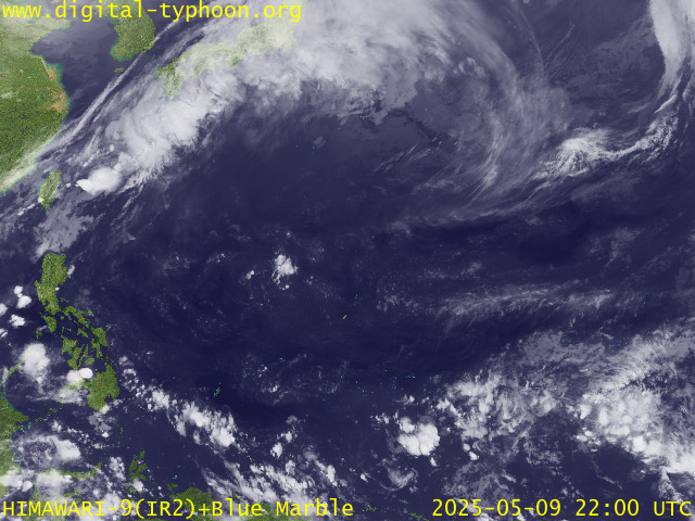
RECENT MTSAT-1R SATELLITE IMAGE:

> Image source: Digital-Typhoon.Org (http://www.digital-typhoon.org/ )
__________________________________________________________________________________________
NOTES:

> Image source: Digital-Typhoon.
^ - JTWC commentary remarks (for Meteorologists) from their
latest warning.
latest warning.
* - Based on PAGASA's Philippine Storm Warning Signals,
# 4 being the highest. Red letters indicate new areas
being hoisted. For more explanations on these signals,
visit: http://www.typhoon2000.ph/signals.htm
** - Based on the Tropical Cyclone's Wave Height near
its center.
__________________________________________________________________________________________
>> To know the meteorological terminologies and acronyms
used on this update visit the ff:
http://typhoon2000.ph/tcterm.htm
http://www.nhc.noaa.gov/aboutgloss.shtml
http://www.srh.noaa.gov/oun/severewx/glossary.php
http://www.srh.weather.gov/fwd/glossarynation.html
http://www.nhc.noaa.gov/acronyms.shtml
__________________________________________________________________________________________
:: Typhoon2000.com (T2K) Mobile >> Powered by: Synermaxx
Receive the latest storm updates directly to your mobile phones! To know more:
Send T2K HELP to: 2800 (GLOBE & TM) | 216 (SMART & TNT) | 2288 (SUN)
Note: Globe & Smart charges P2.50 per message, while Sun at P2.00.
__________________________________________________________________________________________
For the complete details on TS 07W (FRANK)...go visit
our website @:
> http://www.typhoon2000.com
> http://www.maybagyo.com
# 4 being the highest. Red letters indicate new areas
being hoisted. For more explanations on these signals,
visit: http://www.typhoon2
** - Based on the Tropical Cyclone's Wave Height near
its center.
____________
>> To know the meteorological terminologies and acronyms
used on this update visit the ff:
http://typhoon2000.
http://www.nhc.
http://www.srh.
http://www.srh.
http://www.nhc.
____________
:: Typhoon2000.
Receive the latest storm updates directly to your mobile phones! To know more:
Send T2K HELP to: 2800 (GLOBE & TM) | 216 (SMART & TNT) | 2288 (SUN)
Note: Globe & Smart charges P2.50 per message, while Sun at P2.00.
For the complete details on TS 07W (FRANK)...go visit
our website @:
> http://www.typhoon2
> http://www.maybagyo
Copyright © 2008 Typhoon2000.
MARKETPLACE
Change settings via the Web (Yahoo! ID required)
Change settings via email: Switch delivery to Daily Digest | Switch format to Traditional
Visit Your Group | Yahoo! Groups Terms of Use | Unsubscribe
.
__,_._,___
No comments:
Post a Comment