Typhoon2000 STORM UPDATE #003
Name: TYPHOON NAKRI [06W/0805]
Issued: 7:00 AM MANILA TIME (23:00 GMT) THU 29 MAY 2008
Source: JTWC TROPICAL CYCLONE WARNING NUMBER 008
Note: Kindly refer to your country's official warnings or bulletins. This update is for additional information purposes only.
Source: JTWC TROPICAL CYCLONE WARNING NUMBER 008
Note: Kindly refer to your country's official warnings or bulletins. This update is for additional information purposes only.
_____________________________________________________________________________
NAKRI (06W) BECOMES THE 4TH TYPHOON OF THE 2008 SEASON..STILL BARELY
MOVING WITH A DRIFT TOWARDS THE WEST-NORTHWEST... MOVING CLOSER TO THE
PHILIPPINE AREA OF RESPONSIBILITY (PAR)...STILL NOT A THREAT TO THE
PHILIPPINE ISLANDS.
+ FORECAST OUTLOOK: NAKRI is expected to drift NW'ly for the next
PHILIPPINE AREA OF RESPONSIBILITY (PAR)...STILL NOT A THREAT TO THE
PHILIPPINE ISLANDS.
+ FORECAST OUTLOOK: NAKRI is expected to drift NW'ly for the next
24-36 hours, & shall then enter PAR early tomorrow morning. The 2
to 5-day long range forecast shows NAKRI reaching Category 3 on the
Saffir-Simpson Scale, with projected winds of 185 km/hr. It shall
turn Northward before recurving NNE to NE on Saturday, May 31..and
starts to transition into an Extratropical Cyclone as it passes close
to the north of Chichi Jima Island by early Monday morning, June 2.
+ EFFECTS: NAKRI's compact and intense circulation associated with its
+ EFFECTS: NAKRI's compact and intense circulation associated with its
radial, spiral, counter-clockwise cloud bands remains at sea and is not
affecting any small or large islands at the moment.
+ TROPICAL CYCLONE WATCH: Meanwhile, Tropical Disturbance 92W (LPA/1010)
has dissipated and is no longer a suspect for TC development.
+ CURRENT ITCZ/MONSOON TROUGH: ITCZ (aka. Monsoon Trough) affecting NCR,
+ TROPICAL CYCLONE WATCH: Meanwhile, Tropical Disturbance 92W (LPA/1010)
has dissipated and is no longer a suspect for TC development.
+ CURRENT ITCZ/MONSOON TROUGH: ITCZ (aka. Monsoon Trough) affecting NCR,
Luzon, Rest of Visayas and Mindanao - will continue to bring scattered
rains and thunderstorms - most especially in the afternoon or evening.
Important Note: Please keep in mind that the above forecast outlook,
effects & current monsoon intensity, and tropical cyclone watch changes
every 06 to 12 hours!
_____________________________________________________________________________
TIME/DATE: 5:00 AM MANILA TIME (21:00 GMT) 29 MAY
LOCATION OF EYE: LATITUDE 16.2º N...LONGITUDE 136.3º E
DISTANCE 1: 140 KM (75 NM) EAST OF PAR
effects & current monsoon intensity, and tropical cyclone watch changes
every 06 to 12 hours!
____________
LOCATION OF EYE: LATITUDE 16.2º N...LONGITUDE 136.3º E
DISTANCE 1: 140 KM (75 NM) EAST OF PAR
DISTANCE 2: 1,090 KM (590 NM) SSW OF IWO TO
DISTANCE 3: 1,315 KM (710 NM) ENE OF BICOL REGION, PH
DISTANCE 4: 1,430 KM (772 NM) SE OF OKINAWA, JAPAN
DISTANCE 5: 1,515 KM (817 NM) EAST OF CASIGURAN, AURORA, PH
MAX WINDS [1-MIN AVG]: 150 KM/HR (80 KTS) NEAR THE CENTER
PEAK WIND GUSTS: 185 KM/HR (100 KTS)
SAFFIR-SIMPSON SCALE: CATEGORY ONE (1)
MINIMUM CENTRAL PRESSURE (est.): 963 MILLIBARS (hPa)
RECENT MOVEMENT: WNW @ 05 KM/HR (03 KTS)
GENERAL DIRECTION: NORTHERN PHILIPPINE SEA
STORM'S SIZE (IN DIAMETER): 590 KM (320 NM)/AVERAGE
MAX WAVE HEIGHT**: 23 FEET (7.0 METERS)
VIEW TRACKING MAP: 2 AM MANILA TIME THU MAY 29
TSR WIND PROBABILITIES: CURRENT TO 120 HRS LEAD
PHILIPPINE STORM SIGNALS*: N/A
12, 24, 48 & 72 HR. FORECAST:
2 PM (06 GMT) 29 MAY: 16.6N 135.8E / 160-195 KPH / NW @ 09 KPH
2 AM (18 GMT) 30 MAY: 17.3N 135.2E / 165-205 KPH / NNW @ 11 KPH
2 AM (18 GMT) 31 MAY: 19.6N 134.6E / 185-230 KPH / NNE @ 22 KPH
2 AM (18 GMT) 01 JUNE: 24.0N 136.7E / 150-185 KPH / NE @ 28 KPH
REMARKS: 2 AM (18 GMT) 29 MAY POSITION: 16.0N 136.4E.
^TYPHOON (TY) 06W (NAKRI) INTENSIFIED STEADILY OVER THE PAST
12 HOURS AS IT RESUMED A MORE NORTHWEST TO NORTH-NORTHWESTWARD
TRACK AS THE RIDGE TO THE NORTHEAST HAS STRENGTHENED POLEWARD OF
THE SYSTEM. THE FORWARD TRACK SPEED HAS DECREASED AND A MICROWAVE
EYE FEATURE IS EVIDENT IN A 5PM MAY 28 TRMM MICROWAVE SATELLITE IMAGE
AND A 6:04 PM MAY 28 SSMI MICROWAVE SATELLITE IMAGE. RECENT ANIMATED
WATER VAPOR SATELLITE IMAGERY SHOWS IMPROVED EQUATORWARD OUTFLOW, BUT
POLEWARD OUTFLOW HAS DECREASED AS THE MIDLATITUDE TROUGH THAT WAS
PREVIOUSLY ENHANCING POLEWARD OUTFLOW HAS MOVED EASTWARD AND THE
AFOREMENTIONED RIDGING HAS BUILT POLEWARD OF THE SYSTEM...(more)
>> NAKRI {pronounced: na~kree}, meaning: A kind of flower.
Name contributed by: Cambodia.
_____________________________________________________________________________
2 AM (18 GMT) 01 JUNE: 24.0N 136.7E / 150-185 KPH / NE @ 28 KPH
REMARKS: 2 AM (18 GMT) 29 MAY POSITION: 16.0N 136.4E.
^TYPHOON (TY) 06W (NAKRI) INTENSIFIED STEADILY OVER THE PAST
12 HOURS AS IT RESUMED A MORE NORTHWEST TO NORTH-NORTHWESTWARD
TRACK AS THE RIDGE TO THE NORTHEAST HAS STRENGTHENED POLEWARD OF
THE SYSTEM. THE FORWARD TRACK SPEED HAS DECREASED AND A MICROWAVE
EYE FEATURE IS EVIDENT IN A 5PM MAY 28 TRMM MICROWAVE SATELLITE IMAGE
AND A 6:04 PM MAY 28 SSMI MICROWAVE SATELLITE IMAGE. RECENT ANIMATED
WATER VAPOR SATELLITE IMAGERY SHOWS IMPROVED EQUATORWARD OUTFLOW, BUT
POLEWARD OUTFLOW HAS DECREASED AS THE MIDLATITUDE TROUGH THAT WAS
PREVIOUSLY ENHANCING POLEWARD OUTFLOW HAS MOVED EASTWARD AND THE
AFOREMENTIONED RIDGING HAS BUILT POLEWARD OF THE SYSTEM...(more)
>> NAKRI {pronounced: na~kree}, meaning: A kind of flower.
Name contributed by: Cambodia.
____________
_____________________________________________________________________________
RECENT WUNDERGROUND.COM TRACKING CHART :
RECENT WUNDERGROUND.
________________________
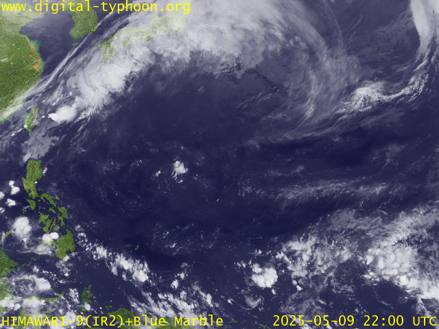
RECENT MTSAT-1R SATELLITE IMAGE:

> Image source: Digital-Typhoon.Org (http://www.digital-typhoon.org/ )
__________________________________________________________________________________________
NOTES:

> Image source: Digital-Typhoon.
^ - JTWC commentary remarks (for Meteorologists) from their
latest warning.
latest warning.
* - Based on PAGASA's Philippine Storm Warning Signals,
# 4 being the highest. Red letters indicate new areas
being hoisted. For more explanations on these signals,
visit: http://www.typhoon2000.ph/signals.htm
** - Based on the Tropical Cyclone's Wave Height near
its center.
__________________________________________________________________________________________
>> To know the meteorological terminologies and acronyms
used on this update visit the ff:
http://typhoon2000.ph/tcterm.htm
http://www.nhc.noaa.gov/aboutgloss.shtml
http://www.srh.noaa.gov/oun/severewx/glossary.php
http://www.srh.weather.gov/fwd/glossarynation.html
http://www.nhc.noaa.gov/acronyms.shtml
__________________________________________________________________________________________
:: Typhoon2000.com (T2K) Mobile >> Powered by: Synermaxx
Receive the latest storm updates directly to your mobile phones! To know more:
Send T2K HELP to: 2800 (GLOBE & TM) | 216 (SMART & TNT) | 2288 (SUN)
Note: Globe & Smart charges P2.50 per message, while Sun at P2.00.
__________________________________________________________________________________________
For the complete details on TY NAKRI (06W)...go visit
our website @:
> http://www.typhoon2000.com
> http://www.maybagyo.com
# 4 being the highest. Red letters indicate new areas
being hoisted. For more explanations on these signals,
visit: http://www.typhoon2
** - Based on the Tropical Cyclone's Wave Height near
its center.
____________
>> To know the meteorological terminologies and acronyms
used on this update visit the ff:
http://typhoon2000.
http://www.nhc.
http://www.srh.
http://www.srh.
http://www.nhc.
____________
:: Typhoon2000.
Receive the latest storm updates directly to your mobile phones! To know more:
Send T2K HELP to: 2800 (GLOBE & TM) | 216 (SMART & TNT) | 2288 (SUN)
Note: Globe & Smart charges P2.50 per message, while Sun at P2.00.
For the complete details on TY NAKRI (06W)...go visit
our website @:
> http://www.typhoon2
> http://www.maybagyo
Copyright © 2008 Typhoon2000.
Change settings via the Web (Yahoo! ID required)
Change settings via email: Switch delivery to Daily Digest | Switch format to Traditional
Visit Your Group | Yahoo! Groups Terms of Use | Unsubscribe
.
__,_._,___
No comments:
Post a Comment