Typhoon2000 STORM UPDATE #002
Name: TROPICAL STORM WIPHA [GORING/13W/0712]
Issued: 7:00 PM MANILA TIME (11:00 GMT) SUN 16 SEPTEMBER 2007
Next Update: 7:00 AM (23:00 GMT) MON 17 SEPTEMBER
Source: JTWC TROPICAL CYCLONE WARNING #005
Note: Kindly refer to your country's official warnings or bulletins. This update is for additional information purposes only.
Next Update: 7:00 AM (23:00 GMT) MON 17 SEPTEMBER
Source: JTWC TROPICAL CYCLONE WARNING #005
Note: Kindly refer to your country's official warnings or bulletins. This update is for additional information purposes only.
_____________________________________________________________________________
TROPICAL STORM WIPHA (GORING)
RAPIDLY INTENSIFIED AS IT MOVES SLOWLYWEST-NORTHWEST ACROSS THE NORTHERN PHILIPPINE SEA.
+ FORECAST OUTLOOK: WIPHA is expected to continue moving WNW for the
+ FORECAST OUTLOOK: WIPHA is expected to continue moving WNW for the
next 24 to 36 hours, becoming a Category 1 typhoon tomorrow afternoon.
The core of WIPHA is forecast to pass over the Islands of Senkaku
around Tuesday afternoon Sept 18 as a Category 2 system. The 3 to 5-
day forecast shows the system reaching its peak winds of 195-km/hr
(Category 3) while starting to initiate a recurvature near the coast
of Eastern China around Wednesday & Thursday (Sept 19-20). It shall
make landfall over South Korea as a weakened system (Category 1) on
Friday afternoon, Sept 21 - passing very close to the south of Seoul.
+ EFFECTS: WIPHA is not yet affecting any Pacific Islands at this moment
+ EFFECTS: WIPHA is not yet affecting any Pacific Islands at this moment
as it remains over the open sea.
+ CURRENT MONSOON INTENSITY: Moderate Southwest Monsoon embedded along
the wet-phase of the Madden-Julian Oscillation (MJO) continues to be
+ CURRENT MONSOON INTENSITY: Moderate Southwest Monsoon embedded along
the wet-phase of the Madden-Julian Oscillation (MJO) continues to be
enhanced by Tropical Storm WIPHA (GORING) located over the Northern
Philippine Sea. Cloudy skies with light to moderate & sometimes heavy
rainfall caused by thunderstorms & SW'ly winds of 15 km/hr or higher
can be expected along the western sections of Bicol Region, Southern
Luzon, Visayas and Mindanao. Meanwhile, strong Thunderstorms embedded
along the ITCZ (Monsoon Trough) are currently moving across Central
Luzon. Landslides and flooding is likely to occur along steep mountain
slopes, river banks, low-lying & flood-prone areas of the affected
areas.
Important Note: Please keep in mind that the above forecast outlook,
effects & current monsoon intensity, and tropical cyclone watch changes
every 06 to 12 hours!
_____________________________________________________________________________
TIME/DATE: 5:00 PM MANILA TIME (09:00 GMT) 16 SEPTEMBER
LOCATION OF CENTER: LATITUDE 20.7º N...LONGITUDE 130.4º E
DISTANCE 1: 885 KM (478 NM) ENE OF BASCO, BATANES, PH
effects & current monsoon intensity, and tropical cyclone watch changes
every 06 to 12 hours!
____________
TIME/DATE: 5:00 PM MANILA TIME (09:00 GMT) 16 SEPTEMBER
LOCATION OF CENTER: LATITUDE 20.7º N...LONGITUDE 130.4º E
DISTANCE 1: 885 KM (478 NM) ENE OF BASCO, BATANES, PH
DISTANCE 2: 690 KM (372 NM) SSE OF OKINAWA, JAPAN
DISTANCE 3: 1,100 KM (593 NM) NE OF NAGA CITY, PH
MAX SUSTAINED WINDS [1-MIN AVG]: 85 KM/HR (45 KTS)PEAK WIND GUSTS: 100 KM/HR (55 KTS)
SAFFIR-SIMPSON SCALE: N/A
MINIMUM CENTRAL PRESSURE (est.): 989 MILLIBARS (hPa)
RECENT MOVEMENT: WNW @ 11 KM/HR (06 KTS)
GENERAL DIRECTION: SENKAKU ISLANDS
STORM'S SIZE (IN DIAMETER): 480 KM (260 NM)/AVERAGE
MAX WAVE HEIGHT**: 14 FEET (4.2 METERS)
VIEW TRACKING MAP: 3 PM JAPAN TIME SUN SEPTEMBER 16
TSR WIND PROBABILITIES: CURRENT TO 120 HRS LEAD
PHILIPPINE STORM SIGNALS*: N/A
12, 24 & 48 HR. FORECAST:
2 AM (18 GMT) 17 SEPTEMBER: 21.4N 129.3E / 100-130 KPH / NW @ 17 KPH
2 PM (06 GMT) 17 SEPTEMBER: 22.4N 127.6E / 120-150 KPH / NW @ 19 KPH
2 PM (06 GMT) 18 SEPTEMBER: 24.9N 124.6E / 165-205 KPH / NNW @ 19 KPH
REMARKS: 2 PM (06 GMT) 16 SEPTEMBER POSITION: 20.4N 130.7E.
^TROPICAL STORM (TS) WIPHA HAS BEEN SLOW TO ORGANIZE, DUE TO A
SMALL TUTT CELL TO ITS NORTH WHICH HAS SUPPRESSED CONVECTION
OVER THE NORTHERN SEMI-CIRCLE OF THE LOW LEVEL CIRCULATION CENTER
(LLCC). THE STORM HAS BEEN SLOWLY TRACKING WESTWARD AS IT CONTINUES
TO CONSOLIDATE. AN UPPER LEVEL ANTICYCLONE TO THE EAST OF THE SYSTEM
IS PROVIDING EXCELLENT EQUATORWARD OUTFLOW...(more)
>> WIPHA {pronounced: wee~faa}, meaning: Name of woman.
Name contributed by: Thailand.
_____________________________________________________________________________
REMARKS: 2 PM (06 GMT) 16 SEPTEMBER POSITION: 20.4N 130.7E.
^TROPICAL STORM (TS) WIPHA HAS BEEN SLOW TO ORGANIZE, DUE TO A
SMALL TUTT CELL TO ITS NORTH WHICH HAS SUPPRESSED CONVECTION
OVER THE NORTHERN SEMI-CIRCLE OF THE LOW LEVEL CIRCULATION CENTER
(LLCC). THE STORM HAS BEEN SLOWLY TRACKING WESTWARD AS IT CONTINUES
TO CONSOLIDATE. AN UPPER LEVEL ANTICYCLONE TO THE EAST OF THE SYSTEM
IS PROVIDING EXCELLENT EQUATORWARD OUTFLOW...(more)
>> WIPHA {pronounced: wee~faa}, meaning: Name of woman.
Name contributed by: Thailand.
____________
PAGASA CURRENT POSITION, MOVEMENT AND INTENSITY (10-min. ave.):
> 2 PM (06 GMT) 16 SEPTEMBER: 20.2N 130.6E / WNW @ 11 KPH / 85 kph
:: For the complete PAGASA bulletin, kindly visit their website at:
http://www.pagasa.dost.gov.ph/wb/tcupdate.shtml
:: For the complete PAGASA bulletin, kindly visit their website at:
http://www.pagasa.
_____________________________________________________________________________
RECENT TRACKING CHART:
RECENT TRACKING CHART:
________________________
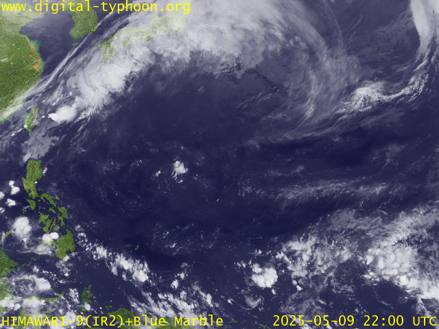
RECENT MTSAT-1R SATELLITE IMAGE:

> Image source: Digital-Typhoon.org (Nat'l. Institute of Informatics) (http://www.digital-typhoon.org )
__________________________________________________________________________________________
NOTES:

> Image source: Digital-Typhoon.
^ - JTWC commentary remarks (for Meteorologists) from their
latest warning.
latest warning.
* - Based on PAGASA's Philippine Storm Warning Signals,
# 4 being the highest. Red letters indicate new areas
being hoisted. For more explanations on these signals,
visit: http://www.typhoon2000.ph/signals.htm
** - Based on the Tropical Cyclone's Wave Height near
its center.
__________________________________________________________________________________________
>> To know the meteorological terminologies and acronyms
used on this update visit the ff:
http://typhoon2000.ph/tcterm.htm
http://www.nhc.noaa.gov/aboutgloss.shtml
http://www.srh.noaa.gov/oun/severewx/glossary.php
http://www.srh.weather.gov/fwd/glossarynation.html
http://www.nhc.noaa.gov/acronyms.shtml
__________________________________________________________________________________________
:: Typhoon2000.com (T2K) Mobile >> Powered by: Synermaxx
Receive the latest storm updates directly to your mobile phones! To know more:
Send T2K HELP to: 2800 (GLOBE & TM) | 216 (SMART & TNT) | 2288 (SUN)
Note: Globe & Smart charges P2.50 per message, while Sun at P2.00.
__________________________________________________________________________________________
For the complete details on TS WIPHA (GORING)...go visit
our website @:
> http://www.typhoon2000.com
> http://www.maybagyo.com
# 4 being the highest. Red letters indicate new areas
being hoisted. For more explanations on these signals,
visit: http://www.typhoon2
** - Based on the Tropical Cyclone's Wave Height near
its center.
____________
>> To know the meteorological terminologies and acronyms
used on this update visit the ff:
http://typhoon2000.
http://www.nhc.
http://www.srh.
http://www.srh.
http://www.nhc.
____________
:: Typhoon2000.
Receive the latest storm updates directly to your mobile phones! To know more:
Send T2K HELP to: 2800 (GLOBE & TM) | 216 (SMART & TNT) | 2288 (SUN)
Note: Globe & Smart charges P2.50 per message, while Sun at P2.00.
For the complete details on TS WIPHA (GORING)...go visit
our website @:
> http://www.typhoon2
> http://www.maybagyo
Change settings via the Web (Yahoo! ID required)
Change settings via email: Switch delivery to Daily Digest | Switch format to Traditional
Visit Your Group | Yahoo! Groups Terms of Use | Unsubscribe
.
__,_._,___
No comments:
Post a Comment