
Typhoon2000 STORM UPDATE #008 **FINAL**
Name: TROPICAL STORM WIPHA [GORING/13W/0712]
Issued: 7:00 PM MANILA TIME (11:00 GMT) WED 19 SEPTEMBER 2007
Source: JTWC TROPICAL CYCLONE WARNING #017 [FINAL]
Note: Kindly refer to your country's official warnings or bulletins. This update is for additional information purposes only.
Source: JTWC TROPICAL CYCLONE WARNING #017 [FINAL]
Note: Kindly refer to your country's official warnings or bulletins. This update is for additional information purposes only.
_____________________________________________________________________________
WIPHA (GORING)
DOWNGRADED INTO A TROPICAL STORM AS IT TRAVERSES THE PROVINCE OF ZHEJIANG...NOW STARTS TRANSITIONING INTO AN EXTRATROPICAL
moves Northward across Jiangsu Province, China later tonight until
tomorrow.
+ EFFECTS: WIPHA's core (eyewall & eye) dissipating along Zhejiang
+ EFFECTS: WIPHA's core (eyewall & eye) dissipating along Zhejiang
Province or just NW of Wenzhou City. Its inner rainbands continues
to spread across the provinces of Zhejiang & Fujian, while its outer
rainbands now affecting the Province of Jiangsu. Gale-force winds
with moderate to very heavy rains can be expected along & near its
core, while strong winds with light to moderate passing rains can be
expected along its inner bands with decreasing intensity over the
outer bands. Flash floods and mudslides are imminent along river
banks, low-lying and mountainous regions of the affected areas.
Precautionary measures must be initiated as the typhoon remains
Monsoon embedded along the wet-phase of the Madden-Julian Oscillation
(MJO) is currently bringing cloudy skies with light to moderate to
(MJO) is currently bringing cloudy skies with light to moderate to
sometimes heavy rainfall & SW'ly winds of 15 km/hr or higher can be
expected along the western sections of Central & Southern Luzon,
Bicol Region and Visayas becoming more intense along Zambales,
Bataan, Metro Manila, Mindoro, Batangas, Palawan & Calamian Group,
Romblon and the Western portions of Panay and Negros Islands inclu-
ding Boracay and Guimaras. Landslides and flooding is likely to occur
along steep mountain slopes, river banks, low-lying & flood-prone
areas of the affected areas.
Important Note: Please keep in mind that the above forecast outlook,
effects & current monsoon intensity, and tropical cyclone watch changes
every 06 to 12 hours!
_____________________________________________________________________________
TIME/DATE: 5:00 PM MANILA TIME (09:00 GMT) 19 SEPTEMBER
LOCATION OF CENTER: LATITUDE 29.7º N...LONGITUDE 118.9º E
DISTANCE 1: 260 KM (140 NM) NW OF WENZHOU, CHINA
effects & current monsoon intensity, and tropical cyclone watch changes
every 06 to 12 hours!
____________
TIME/DATE: 5:00 PM MANILA TIME (09:00 GMT) 19 SEPTEMBER
LOCATION OF CENTER: LATITUDE 29.7º N...LONGITUDE 118.9º E
DISTANCE 1: 260 KM (140 NM) NW OF WENZHOU, CHINA
DISTANCE 2: 250 KM (135 NM) WEST OF NINGBO, CHINA
DISTANCE 3: 290 KM (157 NM) WSW OF SHANGHAI, CHINA
MAX SUSTAINED WINDS [1-MIN AVG]: 95 KM/HR (50 KTS)PEAK WIND GUSTS: 120 KM/HR (65 KTS)
SAFFIR-SIMPSON SCALE: N/A
MINIMUM CENTRAL PRESSURE (est.): 985 MILLIBARS (hPa)
RECENT MOVEMENT: NNW @ 22 KM/HR (12 KTS)
GENERAL DIRECTION: ZHEJIANG, CHINA
STORM'S SIZE (IN DIAMETER): 665 KM (360 NM)/AVERAGE/LARGE
MAX WAVE HEIGHT**: .. FEET (... METERS)
VIEW TRACKING MAP: 2 PM JAPAN TIME WED SEPTEMBER 19
TSR WIND PROBABILITIES: CURRENT TO 24 HRS LEAD
PHILIPPINE STORM SIGNALS*: N/A
12, 24 HR. FORECAST:
2 AM (18 GMT) 20 SEPTEMBER: 32.1N 118.9E / 55-75 KPH / NNE @ 44 KPH
2 PM (06 GMT) 20 SEPTEMBER: 36.5N 121.1E / 45-65 KPH / ... @ .. KPH
REMARKS: 2 PM (06 GMT) 19 SEPTEMBER POSITION: 28.9N 118.9E.
^...(more)
>> WIPHA {pronounced: wee~faa}, meaning: Name of woman.
Name contributed by: Thailand.
____________
_____________________________________________________________________________
RECENT TRACKING CHART:
RECENT TRACKING CHART:
________________________
RECENT MTSAT-1R SATELLITE IMAGE:
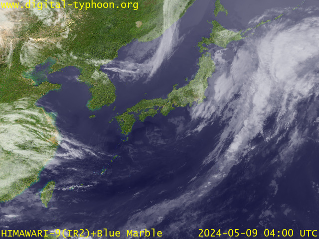
> Image source: Digital-Typhoon.org (Nat'l. Institute of Informatics) (http://www.digital-typhoon.org )
__________________________________________________________________________________________
NOTES:
> Image source: Digital-Typhoon.
^ - JTWC commentary remarks (for Meteorologists) from their
latest warning.
latest warning.
* - Based on PAGASA's Philippine Storm Warning Signals,
# 4 being the highest. Red letters indicate new areas
being hoisted. For more explanations on these signals,
visit: http://www.typhoon2000.ph/signals.htm
** - Based on the Tropical Cyclone's Wave Height near
its center.
__________________________________________________________________________________________
>> To know the meteorological terminologies and acronyms
used on this update visit the ff:
http://typhoon2000.ph/tcterm.htm
http://www.nhc.noaa.gov/aboutgloss.shtml
http://www.srh.noaa.gov/oun/severewx/glossary.php
http://www.srh.weather.gov/fwd/glossarynation.html
http://www.nhc.noaa.gov/acronyms.shtml
__________________________________________________________________________________________
:: Typhoon2000.com (T2K) Mobile >> Powered by: Synermaxx
Receive the latest storm updates directly to your mobile phones! To know more:
Send T2K HELP to: 2800 (GLOBE & TM) | 216 (SMART & TNT) | 2288 (SUN)
Note: Globe & Smart charges P2.50 per message, while Sun at P2.00.
__________________________________________________________________________________________
For the complete details on TS WIPHA (GORING)...go visit
our website @:
> http://www.typhoon2000.com
> http://www.maybagyo.com
# 4 being the highest. Red letters indicate new areas
being hoisted. For more explanations on these signals,
visit: http://www.typhoon2
** - Based on the Tropical Cyclone's Wave Height near
its center.
____________
>> To know the meteorological terminologies and acronyms
used on this update visit the ff:
http://typhoon2000.
http://www.nhc.
http://www.srh.
http://www.srh.
http://www.nhc.
____________
:: Typhoon2000.
Receive the latest storm updates directly to your mobile phones! To know more:
Send T2K HELP to: 2800 (GLOBE & TM) | 216 (SMART & TNT) | 2288 (SUN)
Note: Globe & Smart charges P2.50 per message, while Sun at P2.00.
For the complete details on TS WIPHA (GORING)...go visit
our website @:
> http://www.typhoon2
> http://www.maybagyo
Change settings via the Web (Yahoo! ID required)
Change settings via email: Switch delivery to Daily Digest | Switch format to Traditional
Visit Your Group | Yahoo! Groups Terms of Use | Unsubscribe
.
__,_._,___

No comments:
Post a Comment