Typhoon2000 STORM UPDATE #001
Name: TROPICAL STORM PABUK [CHEDENG/07W/0706]
Issued: 7:00 PM MANILA TIME (11:00 GMT) SUN 05 AUGUST 2007
Next Update: 7:00 AM (23:00 GMT) MON 06 AUGUST
Source: JTWC TROPICAL CYCLONE WARNING #001
Next Update: 7:00 AM (23:00 GMT) MON 06 AUGUST
Source: JTWC TROPICAL CYCLONE WARNING #001
_______________________________________________________________________
TROPICAL STORM PABUK (CHEDENG) NEWLY-FORMED OVER THE
NORTHERN PHILIPPINE SEA...TO ENTER THE PHILIPPINE AREA
OF RESPONSIBILITY (PAR) TONIGHT...INITIALLY THREATENS
TAIWAN.
+ FORECAST OUTLOOK: PABUK is expected to continue accele-rating WNW throughout the coming week, becoming a 120-km/hr
Typhoon by early Tuesday morning, Aug 7. The 2 to 5-day
forecast shows PABUK accelerating further becoming a 185-
km/hr Category 3 Typhoon before making landfall over Taiwan
on Wednesday evening, Aug 08. This potential typhoon shall
cross Central Taiwan and exit over the Taiwan Strait on
Thursday afternoon, Aug 09 as a downgraded Category 1
Typhoon (150 km/hr). It shall make its last and final land-
fall over Southeastern China, just South of Fuzhou, China
on Friday afternoon, Aug 10.
+ EFFECTS: PABUK's circulation has started to consolidate
with the development of its outer bands especially on its
eastern side. As of the moment, the large circulation
remains over the Northern Philippine Sea only
affecting various shipping lines.
+ CURRENT MONSOON INTENSITY: The Southwest (SW) Monsoon is
now starting to be enhanced by PABUK...Cloudy skies with
possible intermittent passing rains or thunderstorms with
SW'ly winds of 15 km/hr or higher can be expected along the
western sections of Southern Luzon, Visayas & Mindanao par-
ticularly the western sections. This monsoon system may
reach Luzon tomorrow or Tuesday. Meanwhile, very strong
Thunderstorms are now moving across Luzon, bringing
moderate to heavy rains.
+ TROPICAL CYCLONE WATCH: N/A.
outlook, effects & current monsoon intensity, and tropical
cyclone watch changes every 06 to 12 hours!
____________
TIME/DATE: 5:00 PM MANILA TIME (09:00 GMT) 05 AUGUST
LOCATION OF CENTER: LATITUDE 19.5º N...LONGITUDE 135.5º E
DISTANCE 1: 1,090 KM (590 NM) SE OF OKINAWA, JAPAN
DISTANCE 2: 1,465 KM (790 NM) ENE OF APARRI, CAGAYAN, PH
DISTANCE 3: 1,415 KM (765 NM) ESE OF BASCO, BATANES, PH
DISTANCE 4: 1,555 KM (840 NM) SE OF TAIPEI, TAIWAN
MAX SUSTAINED WINDS [1-MIN AVG]: 65 KM/HR (35 KTS)DISTANCE 4: 1,555 KM (840 NM) SE OF TAIPEI, TAIWAN
PEAK WIND GUSTS: 85 KM/HR (45 KTS)
SAFFIR-SIMPSON SCALE: N/A
MINIMUM CENTRAL PRESSURE (est.): 996 MILLIBARS (hPa)
RECENT MOVEMENT: WNW @ 15 KM/HR (08 KTS)
GENERAL DIRECTION: TAIWAN
STORM'S SIZE (IN DIAMETER): 335 KM (180 NM)/ SMALL/AVERAGE
MAX WAVE HEIGHT**: 26 FEET (7.9 METERS)
VIEW T2K TRACKING MAP: 2 PM MANILA TIME AUGUST 05
TSR WIND PROBABILITIES: CURRENT TO 120 HRS LEAD
PHILIPPINE STORM SIGNALS*: N/A
12, 24 & 48 HR. FORECAST:
2 AM (18 GMT) 06 AUGUST: 20.3N 134.0E / 85-100 KPH / WNW @ 20 KPH
2 PM (06 GMT) 06 AUGUST: 21.1N 131.9E / 100-130 KPH / W @ 22 KPH
2 PM (06 GMT) 07 AUGUST: 22.1N 126.8E / 150-185 KPH / WNW @ 20 KPH
REMARKS: 2 PM (06 GMT) 05 AUGUST POSITION: 19.2N 136.0E.
^TROPICAL STORM (TS) 07W (PABUK) HAS UNDERGONE CONSIDERABLE
DEVELOPMENT OVER THE PAST 12 HOURS. THE LOW LEVEL CIRCULA-
TION CENTER (LLCC) HAS CONSOLIDATED UNDER THE MAIN CONVEC-
TION WITH CONVERGENT BANDS WRAPPING IN FROM THE SOUTHEAS-
TERN QUADRANT. ANIMATED MULTISPECTRAL AND ENHANCED INFRARED
SATELLITE IMAGERY SHOW THE LLCC UNDER THE CENTRAL CONVECTION,
WHILE A MICROWAVE IMAGE REVEALS CONVECTION FLARING ON THE
SOUTHERN PERIPHERY OF THE LLCC...(more)
>> PABUK {pronounced: pa~book}, meaning: Big fresh water fish.
Name contributed by: Lao PDR.
_______________________________________________________________________
PAGASA CURRENT POSITION, MOVEMENT AND INTENSITY (10-min. ave.):
REMARKS: 2 PM (06 GMT) 05 AUGUST POSITION: 19.2N 136.0E.
^TROPICAL STORM (TS) 07W (PABUK) HAS UNDERGONE CONSIDERABLE
DEVELOPMENT OVER THE PAST 12 HOURS. THE LOW LEVEL CIRCULA-
TION CENTER (LLCC) HAS CONSOLIDATED UNDER THE MAIN CONVEC-
TION WITH CONVERGENT BANDS WRAPPING IN FROM THE SOUTHEAS-
TERN QUADRANT. ANIMATED MULTISPECTRAL AND ENHANCED INFRARED
SATELLITE IMAGERY SHOW THE LLCC UNDER THE CENTRAL CONVECTION,
WHILE A MICROWAVE IMAGE REVEALS CONVECTION FLARING ON THE
SOUTHERN PERIPHERY OF THE LLCC...(more)
>> PABUK {pronounced: pa~book}, meaning: Big fresh water fish.
Name contributed by: Lao PDR.
____________
PAGASA CURRENT POSITION, MOVEMENT AND INTENSITY (10-min. ave.):
> 2 PM (06 GMT) 05 AUGUST: 19.6N 135.6E / WNW @ 22 KPH / 65 kph
:: For the complete PAGASA bulletin, kindly visit their website
at: http://www.pagasa.dost.gov.ph/wb/tcupdate.shtml
:: For the complete PAGASA bulletin, kindly visit their website
at: http://www.pagasa.
_______________________________________________________________________
RECENT TRACKING CHART:
________________________
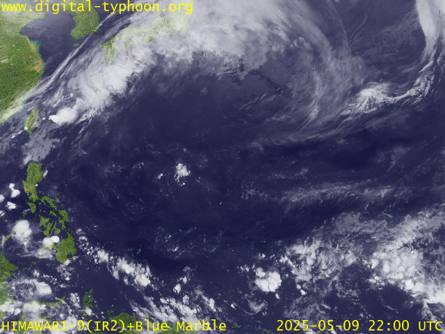
RECENT MTSAT-1R SATELLITE IMAGE:

> Image source: Digital-Typhoon.org (Nat'l. Institute of Informatics) (http://www.digital-typhoon.org )
__________________________________________________________________________________________
NOTES:

> Image source: Digital-Typhoon.
^ - JTWC commentary remarks (for Meteorologists) from their
latest warning.
latest warning.
* - Based on PAGASA's Philippine Storm Warning Signals,
# 4 being the highest. Red letters indicate new areas
being hoisted. For more explanations on these signals,
visit: http://www.typhoon2000.ph/signals.htm
** - Based on the Tropical Cyclone's Wave Height near
its center.
__________________________________________________________________________________________
>> To know the meteorological terminologies and acronyms
used on this update visit the ff:
http://typhoon2000.ph/tcterm.htm
http://www.nhc.noaa.gov/aboutgloss.shtml
http://www.srh.noaa.gov/oun/severewx/glossary.php
http://www.srh.weather.gov/fwd/glossarynation.html
http://www.nhc.noaa.gov/acronyms.shtml
__________________________________________________________________________________________
:: Typhoon2000.com (T2K) Mobile >> Powered by: Synermaxx
Receive the latest storm updates directly to your mobile phones! To know more:
Send T2K HELP to: 2800 (GLOBE & TM) | 216 (SMART & TNT) | 2288 (SUN)
Note: Globe & Smart charges P2.50 per message, while Sun at P2.00.
__________________________________________________________________________________________
For the complete details on TS PABUK (CHEDENG)...go visit
our website @:
> http://www.typhoon2000.com
> http://www.maybagyo.com
# 4 being the highest. Red letters indicate new areas
being hoisted. For more explanations on these signals,
visit: http://www.typhoon2
** - Based on the Tropical Cyclone's Wave Height near
its center.
____________
>> To know the meteorological terminologies and acronyms
used on this update visit the ff:
http://typhoon2000.
http://www.nhc.
http://www.srh.
http://www.srh.
http://www.nhc.
____________
:: Typhoon2000.
Receive the latest storm updates directly to your mobile phones! To know more:
Send T2K HELP to: 2800 (GLOBE & TM) | 216 (SMART & TNT) | 2288 (SUN)
Note: Globe & Smart charges P2.50 per message, while Sun at P2.00.
For the complete details on TS PABUK (CHEDENG)...
our website @:
> http://www.typhoon2
> http://www.maybagyo
Change settings via the Web (Yahoo! ID required)
Change settings via email: Switch delivery to Daily Digest | Switch format to Traditional
Visit Your Group | Yahoo! Groups Terms of Use | Unsubscribe
SPONSORED LINKS
.
__,_._,___
No comments:
Post a Comment