Typhoon2000 STORM UPDATE #004
Name: TROPICAL DEPRESSION WUTIP [DODONG/08W/0707]
Issued: 7:00 PM MANILA TIME (11:00 GMT) THU 09 AUGUST 2007
Next Update: 7:00 AM (23:00 GMT) FRI 10 AUGUST
Source: JTWC TROPICAL CYCLONE WARNING #008
Next Update: 7:00 AM (23:00 GMT) FRI 10 AUGUST
Source: JTWC TROPICAL CYCLONE WARNING #008
_______________________________________________________________________
WUTIP (DODONG) CONSIDERABLY WEAKENED INTO A TROPICAL
DEPRESSION AFTER TRAVERSING CENTRAL TAIWAN...NOW OFF THE WESTERN COAST OF TAIWAN. THIS SYSTEM WILL STILL
CONTINUE TO PULL THE SOUTHWEST MONSOON, BRINGING CLOUDY
SKIES WITH OCCASIONAL RAINS ACROSS WESTERN LUZON.
+ FORECAST OUTLOOK: WUTIP is expected to move across
+ FORECAST OUTLOOK: WUTIP is expected to move across
the Taiwan Strait and weaken further after moving over
Southeastern China. The system shall continue moving
inland, across the rugged terrain of China, dissipa-
ting tomorrow.
+ EFFECTS: WUTIP's circulation remains weak and conti-
+ EFFECTS: WUTIP's circulation remains weak and conti-
nues to affect Taiwan Strait, Southern Taiwan, SE China,
Balintang and Bashi Channel, Batanes and Babuyan Islands.
Moderate to heavy rains and gusty winds can be expected
along the circulation of this system. Flash floods and
mudslides are imminent along river banks, low-lying and
mountainous regions of the affected areas. Precautionary
measures must be initiated as the system passes by.
+ CURRENT MONSOON INTENSITY: The Southwest (SW) Monsoon
+ CURRENT MONSOON INTENSITY: The Southwest (SW) Monsoon
remains under the influence of WUTIP...Cloudy skies with
occasional rains with SW'ly winds of 20 km/hr or higher
can be expected along Luzon (including Bicol Region) -
becoming more frequent along the western sections parti-
cularly Metro Manila, Zambales, Bataan, Pangasinan, La
Union, Benguet, Mindoro, Northern Palawan and the Ilocos
Provinces. Mudslides and flooding is likely along river
banks, low-lying & flood-prone areas of the affected areas.
Stay tuned for more Monsoon updates on the next advisory.
+ TROPICAL CYCLONE WATCH: Two (2) new Tropical Disturbances
+ TROPICAL CYCLONE WATCH: Two (2) new Tropical Disturbances
(LPAs) over the Philippine Sea & Western Marianas area has
maintained its development. The first Tropical Disturbance
(93W/LPA/1002 MB) was estimated to the ESE of WUTIP or
about 475 km ENE of Basco, Batanes (21.2N 126.5E)...
remained almost stationary with sustained winds of 30
km/hr.
The second Tropical Disturbance (LPA/1008 MB) on the other
hand was located about 520 km WNW of Guam or 1,695 km East
of Bicol Region (14.0N 140.0E)...moving WNW at 19 km/hr
towards the Philippine Sea. These 2 disturbances will be
closely monitored for further development in the days to
come.
Important Note: Please keep in mind that the above forecast
outlook, effects & current monsoon intensity, and tropical
cyclone watch changes every 06 to 12 hours!
____________
TIME/DATE: 5:00 PM MANILA TIME (09:00 GMT) 09 AUGUST
LOCATION OF CENTER: LATITUDE 23.8º N...LONGITUDE 120.3º E
DISTANCE 1: 405 KM (220 NM) NW OF BASCO, BATANES, PH
DISTANCE 2: 135 KM (73 NM) WSW OF HUALIEN, TAIWAN
DISTANCE 3: 135 KM (73 NM) NORTH OF KAOSHIUNG, TAIWAN
DISTANCE 4: 185 KM (100 NM) SW OF TAIPEI, TAIWAN
MAX SUSTAINED WINDS [1-MIN AVG]: 45 KM/HR (25 KTS)DISTANCE 4: 185 KM (100 NM) SW OF TAIPEI, TAIWAN
PEAK WIND GUSTS: 65 KM/HR (35 KTS)
SAFFIR-SIMPSON SCALE: N/A
MINIMUM CENTRAL PRESSURE (est.): 1004 MILLIBARS (hPa)
RECENT MOVEMENT: WNW @ 17 KM/HR (09 KTS)
GENERAL DIRECTION: TAIWAN STRAIT-SOUTHEASTERN CHINA
STORM'S SIZE (IN DIAMETER): 555 KM (300 NM)/AVERAGE
MAX WAVE HEIGHT**: 12 FEET (3.6 METERS)
VIEW T2K TRACKING MAP: 2 PM MANILA TIME THU AUGUST 09
TSR WIND PROBABILITIES: CURRENT TO 36 HRS LEAD
PHILIPPINE STORM SIGNALS*:
#01 - BATANES GROUP OF ISLANDS.
12 & 24 HR. FORECAST:
2 AM (18 GMT) 10 AUGUST: 24.5N 118.8E / 45-65 KPH / WNW @ 13 KPH
2 PM (06 GMT) 10 AUGUST: 25.1N 117.5E / 45-65 KPH / N @ 07 KPH
^TROPICAL DEPRESSION (TD) 08W (WUTIP) HAS BECOME MORE DIS-
ORGANIZED OVER THE PAST 12 HOURS, AS IT HAS REMAINED IN A
VERY UNFAVORABLE UPPER LEVEL ENVIRONMENT. ANALYSIS INDICATES
VERY UNFAVORABLE UPPER LEVEL ENVIRONMENT. ANALYSIS INDICATES
STRONG VERTICAL WIND SHEAR AS WELL AS UPPER LEVEL CONVERGENCE
OVER THE REGION, WHICH HAS MADE IT IMPOSSIBLE FOR THE SYSTEM
TO CONSOLIDATE...(more)
>> WUTIP {pronounced: wu~teep}, meaning: Butterfly, it is
an insect with four broad, colorful wings. You can find
OVER THE REGION, WHICH HAS MADE IT IMPOSSIBLE FOR THE SYSTEM
TO CONSOLIDATE...(more)
>> WUTIP {pronounced: wu~teep}, meaning: Butterfly, it is
an insect with four broad, colorful wings. You can find
different kinds of butterfly in the countryside of Macau
islands during Spring and Summer. Name contributed
by: Macau, China.
_______________________________________________________________________
PAGASA CURRENT POSITION, MOVEMENT AND INTENSITY (10-min. ave.):
by: Macau, China.
____________
PAGASA CURRENT POSITION, MOVEMENT AND INTENSITY (10-min. ave.):
> 4 PM (08 GMT) 09 AUGUST: 22.7N 119.7E / WEST @ 15 KPH / 55 kph
:: For the complete PAGASA bulletin, kindly visit their website
at: http://www.pagasa.dost.gov.ph/wb/tcupdate.shtml
:: For the complete PAGASA bulletin, kindly visit their website
at: http://www.pagasa.
_______________________________________________________________________
RECENT TRACKING CHART:
________________________
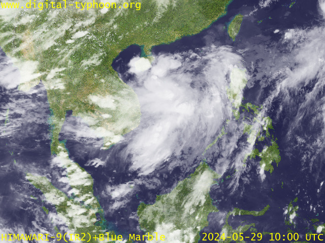
RECENT MTSAT-1R SATELLITE IMAGE:

> Image source: Digital-Typhoon.org (Nat'l. Institute of Informatics) (http://www.digital-typhoon.org )
__________________________________________________________________________________________
NOTES:

> Image source: Digital-Typhoon.
^ - JTWC commentary remarks (for Meteorologists) from their
latest warning.
latest warning.
* - Based on PAGASA's Philippine Storm Warning Signals,
# 4 being the highest. Red letters indicate new areas
being hoisted. For more explanations on these signals,
visit: http://www.typhoon2000.ph/signals.htm
** - Based on the Tropical Cyclone's Wave Height near
its center.
__________________________________________________________________________________________
>> To know the meteorological terminologies and acronyms
used on this update visit the ff:
http://typhoon2000.ph/tcterm.htm
http://www.nhc.noaa.gov/aboutgloss.shtml
http://www.srh.noaa.gov/oun/severewx/glossary.php
http://www.srh.weather.gov/fwd/glossarynation.html
http://www.nhc.noaa.gov/acronyms.shtml
__________________________________________________________________________________________
:: Typhoon2000.com (T2K) Mobile >> Powered by: Synermaxx
Receive the latest storm updates directly to your mobile phones! To know more:
Send T2K HELP to: 2800 (GLOBE & TM) | 216 (SMART & TNT) | 2288 (SUN)
Note: Globe & Smart charges P2.50 per message, while Sun at P2.00.
__________________________________________________________________________________________
For the complete details on TD WUTIP (DODONG)...go visit
our website @:
> http://www.typhoon2000.com
> http://www.maybagyo.com
# 4 being the highest. Red letters indicate new areas
being hoisted. For more explanations on these signals,
visit: http://www.typhoon2
** - Based on the Tropical Cyclone's Wave Height near
its center.
____________
>> To know the meteorological terminologies and acronyms
used on this update visit the ff:
http://typhoon2000.
http://www.nhc.
http://www.srh.
http://www.srh.
http://www.nhc.
____________
:: Typhoon2000.
Receive the latest storm updates directly to your mobile phones! To know more:
Send T2K HELP to: 2800 (GLOBE & TM) | 216 (SMART & TNT) | 2288 (SUN)
Note: Globe & Smart charges P2.50 per message, while Sun at P2.00.
For the complete details on TD WUTIP (DODONG)...go visit
our website @:
> http://www.typhoon2
> http://www.maybagyo
Change settings via the Web (Yahoo! ID required)
Change settings via email: Switch delivery to Daily Digest | Switch format to Traditional
Visit Your Group | Yahoo! Groups Terms of Use | Unsubscribe
SPONSORED LINKS
.
__,_._,___
No comments:
Post a Comment