Typhoon2000 STORM UPDATE #007
Name: TROPICAL DEPRESSION 06W [UNNAMED]
Issued: 7:00 PM MANILA TIME (11:00 GMT) MON 06 AUGUST 2007
Next Update: 7:00 AM (23:00 GMT) TUE 07 AUGUST
Source: JTWC TROPICAL CYCLONE WARNING #015
Next Update: 7:00 AM (23:00 GMT) TUE 07 AUGUST
Source: JTWC TROPICAL CYCLONE WARNING #015
_______________________________________________________________________
TROPICAL DEPRESSION 06W (UNNAMED) STRUGGLING OVER THE GULF
OF TONKIN, NEAR THE SOUTH COAST OF HAINAN AS UNFAVORABLE
CONDITIONS CONTINUES TO AFFECT THE SYSTEM...LIKELY TO
CONDITIONS CONTINUES TO AFFECT THE SYSTEM...LIKELY TO
DISSIPATE WITHIN 24 TO 36 HOURS.
+ FORECAST OUTLOOK: 06W is expected to turn Westward towards the Coast of Vietnam tomorrow morning, and dissipate early
Wednesday morning, Aug 8.
+ EFFECTS: 06W's circulation remains weak and disorganized
and continues to spread across Northwestern Thailand, Cambo-
dia, Laos, Northern Vietnam, Hainan Island and portions of
Southwestern China. The weak convective circulation will
continue to bring scattered moderate to heavy rains over the
area, most especially over the Gulf of Tonkin and the coast-
line of Northern Vietnam. Flash floods and mudslides are
imminent along river banks, low-lying and mountainous areas
of the affected areas of IndoChina. Precautionary measures
must be implemented on the possible effects of this
depression.
+ CURRENT MONSOON INTENSITY: Southwest (SW) Monsoon continues
+ CURRENT MONSOON INTENSITY: Southwest (SW) Monsoon continues
to be enhanced by TD 06W...Cloudy skies with passing occasio-
nal rains & SW'ly winds of 30 km/hr or higher can be expected
along the western sections of Indochina & Malay Peninsula par-
ticularly the western sections of Thailand & Myanmar. Mud-
slides and flooding is likely along river banks, low-lying &
flood-prone areas of the affected areas.
Important Note: Please keep in mind that the above forecast
outlook, effects & current monsoon intensity, and tropical
cyclone watch changes every 06 to 12 hours!
_______________________________________________________________________
TIME/DATE: 5:00 PM MANILA TIME (09:00 GMT) 06 AUGUST
LOCATION OF CENTER: LATITUDE 17.0º N...LONGITUDE 109.0º E
DISTANCE 1: 130 KM (70 NM) NE OF DA NANG, VIETNAM
outlook, effects & current monsoon intensity, and tropical
cyclone watch changes every 06 to 12 hours!
____________
TIME/DATE: 5:00 PM MANILA TIME (09:00 GMT) 06 AUGUST
LOCATION OF CENTER: LATITUDE 17.0º N...LONGITUDE 109.0º E
DISTANCE 1: 130 KM (70 NM) NE OF DA NANG, VIETNAM
DISTANCE 2: 160 KM (85 NM) ENE OF HUE, VIETNAM
DISTANCE 3: 145 KM (78 NM) SSW OF SANYA, HAINAN IS.
DISTANCE 4: 1,235 KM (665 NM) WNW OF BAGUIO CITY, PH
MAX SUSTAINED WINDS [1-MIN AVG]: 45 KM/HR (25 KTS)PEAK WIND GUSTS: 65 KM/HR (35 KTS)
SAFFIR-SIMPSON SCALE: N/A
MINIMUM CENTRAL PRESSURE (est.): 1004 MILLIBARS (hPa)
RECENT MOVEMENT: NORTH @ 09 KM/HR (05 KTS)
GENERAL DIRECTION: VIETNAM
STORM'S SIZE (IN DIAMETER): 400 KM (215 NM)/AVERAGE
MAX WAVE HEIGHT**: 12 FEET (3.6 METERS)
VIEW TRACKING MAP: 2 PM HKT MON AUGUST 06
TSR WIND PROBABILITIES: CURRENT TO 36 HRS LEAD
PHILIPPINE STORM SIGNALS*: N/A
12, 24 & 36 HR. FORECAST:
2 AM (18 GMT) 07 AUGUST: 17.7N 108.5E / 45-65 KPH / WNW @ 07 KPH
2 PM (06 GMT) 07 AUGUST: 18.0N 107.8E / 45-65 KPH / W @ 07 KPH
2 AM (18 GMT) 08 AUGUST: 18.0N 107.0E / 35-55 KPH / W @ 07 KPH
REMARKS: 2 PM (06 GMT) 06 AUGUST POSITION: 16.8N 109.1E.
^TROPICAL DEPRESSION (TD) 06W (NONAME) HAS LOST MUCH OF ITS
ASSOCIATED CONVECTION OVER THE LOW LEVEL CIRCULATION CENTER
(LLCC). THE MOVEMENT HAS BEEN NORTHWARD OVER THE PAST 12 HOURS,
WITH THE LLCC NOW SOUTH OF HAINAN ISLAND. TD 06W IS LOCATED
APPROXIMATELY 90 NM EAST OF HUE, VIETNAM, AND HAS TRACKED
NORTH AT 09 KNOTS OVER THE PAST 06 HOURS. A QUIKSCAT PASS
INDICATES UNFLAGGED WINDS AT THE CENTER OF ONLY 20 KTS. THE
INTENSITY WAS HELD AT 25KTS DUE TO THE DVORAK OF 1.0/1.5,
BUT THE TREND IS DEFINITELY WEAKENING. UPPER-LEVEL ANALYSIS
CONTINUE TO INDICATE MODERATE WIND SHEAR OVER THE LLCC.
OCEAN HEAT CONTENT VALUES IN THE VICINITY OF THE STORM
ARE LOW...(more info)
_______________________________________________________________________
_______________________________________________________________________
RECENT TRACKING CHART:
____________
____________
RECENT TRACKING CHART:
________________________
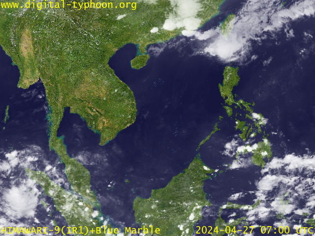
RECENT MTSAT-1R SATELLITE IMAGE:

> Image source: Digital-Typhoon.org (Nat'l. Institute of Informatics) (http://www.digital-typhoon.org )
__________________________________________________________________________________________
NOTES:

> Image source: Digital-Typhoon.
^ - JTWC commentary remarks (for Meteorologists) from their
latest warning.
latest warning.
* - Based on PAGASA's Philippine Storm Warning Signals,
# 4 being the highest. Red letters indicate new areas
being hoisted. For more explanations on these signals,
visit: http://www.typhoon2000.ph/signals.htm
** - Based on the Tropical Cyclone's Wave Height near
its center.
__________________________________________________________________________________________
>> To know the meteorological terminologies and acronyms
used on this update visit the ff:
http://typhoon2000.ph/tcterm.htm
http://www.nhc.noaa.gov/aboutgloss.shtml
http://www.srh....noaa.gov/oun/severewx/glossary.php
http://www.srh.weather.gov/fwd/glossarynation.html
http://www.nhc.noaa.gov/acronyms.shtml
__________________________________________________________________________________________
:: Typhoon2000.com (T2K) Mobile >> Powered by: Synermaxx
Receive the latest storm updates directly to your mobile phones! To know more:
Send T2K HELP to: 2800 (GLOBE & TM) | 216 (SMART & TNT) | 2288 (SUN)
Note: Globe & Smart charges P2.50 per message, while Sun at P2.00.
__________________________________________________________________________________________
For the complete details on TD 06W (UNNAMED)...go visit
our website @:
> http://www.typhoon2000.com
> http://www.maybagyo.com
# 4 being the highest. Red letters indicate new areas
being hoisted. For more explanations on these signals,
visit: http://www.typhoon2
** - Based on the Tropical Cyclone's Wave Height near
its center.
____________
>> To know the meteorological terminologies and acronyms
used on this update visit the ff:
http://typhoon2000.
http://www.nhc.
http://www.srh.
http://www.srh.
http://www.nhc.
____________
:: Typhoon2000.
Receive the latest storm updates directly to your mobile phones! To know more:
Send T2K HELP to: 2800 (GLOBE & TM) | 216 (SMART & TNT) | 2288 (SUN)
Note: Globe & Smart charges P2.50 per message, while Sun at P2.00.
For the complete details on TD 06W (UNNAMED)...
our website @:
> http://www.typhoon2
> http://www.maybagyo
Change settings via the Web (Yahoo! ID required)
Change settings via email: Switch delivery to Daily Digest | Switch format to Traditional
Visit Your Group | Yahoo! Groups Terms of Use | Unsubscribe
SPONSORED LINKS
.
__,_._,___
No comments:
Post a Comment