Typhoon2000 STORM UPDATE #005
Name: TYPHOON YUTU [AMANG/02W/0702]
Issued: 7:00 AM MANILA TIME (23:00 GMT) SAT 19 MAY 2007
Next Update: 7:00 PM (11:00 GMT) SAT 19 MAY 2007
Source: JTWC TROPICAL CYCLONE WARNING #010
Next Update: 7:00 PM (11:00 GMT) SAT 19 MAY 2007
Source: JTWC TROPICAL CYCLONE WARNING #010
_______________________________________________________________________
YUTU (AMANG) BECOMES THE SECOND TYPHOON OF THE 2007
SEASON...NOW HEADING SLIGHTLY NORTH-NORTHWEST...NOT
A THREAT TO THE PHILIPPINES.
+ FORECAST OUTLOOK: YUTU is expected to turn towards the North this afternoon and shall start recurving to the NE
beginning tomorrow. The 2 to 3-day long range forecast
(May 21-22) shows YUTU weakening as it passes over Iwo
Jima Island Tuesday early morning, May 22. Based on this
latest forecast run, this typhoon will not affect any
part of the Philippines.
+ EFFECTS: N/A.
+ CURRENT MONSOON INTENSITY: N/A.
Important Note: Please keep in mind that the above forecast
outlook, effects & current monsoon intensity, and tropical
cyclone watch changes every 06 to 12 hours!
____________
TIME/DATE: 5:00 AM MANILA TIME (21:00 GMT) 19 MAY
LOCATION OF CENTER: LATITUDE 14.5º N...LONGITUDE 132.8º E
DISTANCE 1: 920 KM (497 NM) ENE OF VIRAC, CATANDUANES, PH
DISTANCE 2: 1,040 KM (562 NM) ENE OF NAGA CITY, PH
DISTANCE 3: 1,260 KM (680 NM) EAST OF METRO MANILA, PH
DISTANCE 4: 1,160 KM (627 NM) ESE OF CASIGURAN, AURORA, PH
MAX SUSTAINED WINDS [1-MIN AVG]: 120 KM/HR (65 KTS)PEAK WIND GUSTS: 150 KM/HR (80 KTS)
SAFFIR-SIMPSON SCALE: CATEGORY ONE (1)
MINIMUM CENTRAL PRESSURE (est.): 976 MILLIBARS (hPa)
RECENT MOVEMENT: NW @ 20 KM/HR (11 KTS)
GENERAL DIRECTION: PHILIPPINE SEA
STORM'S SIZE (IN DIAMETER): 630 KM (340 NM)/AVERAGE
MAX WAVE HEIGHT**: 24 FEET (7.3 METERS)
VIEW TRACKING MAP: 2 AM PST SAT MAY 19
TSR WIND PROBABILITIES: CURRENT TO 72 HRS LEAD
PHILIPPINE STORM SIGNALS*: N/A
12 & 24 HR. FORECAST:
2 PM (06 GMT) 19 MAY: 15.8N 132.3E / 150-185 KPH / NNE @ 15 KPH
2 AM (18 GMT) 20 MAY: 17.4N 132.7E / 165-205 KPH / NE @ 15 KPH
REMARKS: 2 AM (18 GMT) 19 MAY POSITION: 14.1N 133.0E.
^RECENT MICROWAVE IMAGERY DEPICT A DISTINCT EYE FEATURE,
LENDING ELEVATED CONFIDENCE TO THE ANALYZED STORM POSITION.
TY YUTU IS TRACKING TOWARD A WEAKNESS IN THE SUBTROPICAL
RIDGE INDUCED BY A MID-LATITUDE TROUGH EXTENDING ACROSS THE
KOREAN PENINSULA AND NORTHEASTERN CHINA. THE SYSTEM WILL
CONTINUE TO TRACK ALONG THE PERIPHERY OF THE PRIMARY STEERING
RIDGE ANCHORED NORTH OF THE MARIANA ISLANDS THROUGHOUT THE
FORECAST PERIOD. TY YUTU WILL CREST THE RIDGE AXIS AROUND 24
HRS AND, THEREAFTER, BEGIN ACCELERATING TOWARD THE NORTHEAST
IN THE STRONG GRADIENT BETWEEN THE STEERING RIDGE AND THE
AFORMENTIONED TROUGH. THE SYSTEM WILL DIRECTLY INTERACT WITH
THIS TROUGH AFTER 48 HRS AND BEGIN EXTRATROPICAL TRANSI-
TION...(more info)
>> YUTU {pronounced: yu~tu}, meaning: The Jade Hare. The
hare which lives on the moon. Chang'e, wife of Yi (a
tribal chief in ancient China), stole her husband's
elixir of immortality, and fled to the moon together
with the hare. They are said to be still living there
in a palace. Name contributed by: China.
_______________________________________________________________________
PAGASA CURRENT POSITION, MOVEMENT AND INTENSITY (10-min. ave.):
RECENT TRACKING CHART:
>> YUTU {pronounced: yu~tu}, meaning: The Jade Hare. The
hare which lives on the moon. Chang'e, wife of Yi (a
tribal chief in ancient China), stole her husband's
elixir of immortality, and fled to the moon together
with the hare. They are said to be still living there
in a palace. Name contributed by: China.
____________
PAGASA CURRENT POSITION, MOVEMENT AND INTENSITY (10-min. ave.):
> 2 AM (18 GMT) 19 MAY: 14.3N 133.0E / NNW @ 15 KPH / 120 kph
:: For the complete PAGASA bulletin, kindly visit their website
at: http://www.pagasa.dost.gov.ph/wb/tcupdate.shtml
_______________________________________________________________________
:: For the complete PAGASA bulletin, kindly visit their website
at: http://www.pagasa.
____________
RECENT TRACKING CHART:
________________________
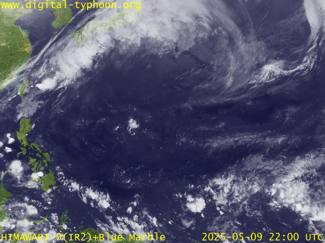
RECENT MTSAT-1R SATELLITE IMAGE:

> Image source: Digital-Typhoon.org (Nat'l. Institute of Informatics) (http://www.digital-typhoon.org )
__________________________________________________________________________________________
NOTES:

> Image source: Digital-Typhoon.
^ - JTWC commentary remarks (for Meteorologists) from their
latest warning.
latest warning.
* - Based on PAGASA's Philippine Storm Warning Signals,
# 4 being the highest. Red letters indicate new areas
being hoisted. For more explanations on these signals,
visit: http://www.typhoon2000.ph/signals.htm
** - Based on the Tropical Cyclone's Wave Height near
its center.
__________________________________________________________________________________________
>> To know the meteorological terminologies and acronyms
used on this update visit the ff:
http://typhoon2000.ph/tcterm.htm
http://www.nhc.noaa.gov/aboutgloss.shtml
http://www.srh.noaa.gov/oun/severewx/glossary.php
http://www.srh.weather.gov/fwd/glossarynation.html
http://www.nhc.noaa.gov/acronyms.shtml
__________________________________________________________________________________________
:: Typhoon2000.com (T2K) Mobile >> Powered by: Synermaxx
Receive the latest storm updates directly to your mobile phones! To know more:
Send T2K HELP to: 2800 (GLOBE & TM) | 216 (SMART & TNT) | 2288 (SUN)
Note: Globe & Smart charges P2.50 per message, while Sun at P2.00.
__________________________________________________________________________________________
For the complete details on TY YUTU (AMANG)...go visit
our website @:
> http://www.typhoon2000.com
> http://www.maybagyo.com
# 4 being the highest. Red letters indicate new areas
being hoisted. For more explanations on these signals,
visit: http://www.typhoon2
** - Based on the Tropical Cyclone's Wave Height near
its center.
____________
>> To know the meteorological terminologies and acronyms
used on this update visit the ff:
http://typhoon2000.
http://www.nhc.
http://www.srh.
http://www.srh.
http://www.nhc.
____________
:: Typhoon2000.
Receive the latest storm updates directly to your mobile phones! To know more:
Send T2K HELP to: 2800 (GLOBE & TM) | 216 (SMART & TNT) | 2288 (SUN)
Note: Globe & Smart charges P2.50 per message, while Sun at P2.00.
For the complete details on TY YUTU (AMANG)...go visit
our website @:
> http://www.typhoon2
> http://www.maybagyo
Change settings via the Web (Yahoo! ID required)
Change settings via email: Switch delivery to Daily Digest | Switch format to Traditional
Visit Your Group | Yahoo! Groups Terms of Use | Unsubscribe
SPONSORED LINKS
.
__,_._,___
No comments:
Post a Comment