Typhoon2000 STORM UPDATE #005
Name: TYPHOON KONG-REY [01W/0701]
Issued: 7:00 AM MANILA TIME (23:00 GMT) TUE 03 APRIL 2007
Next Update: 7:00 PM (11:00 GMT) TUE 03 APRIL 2007
Source: JTWC TROPICAL CYCLONE WARNING #010
Next Update: 7:00 PM (11:00 GMT) TUE 03 APRIL 2007
Source: JTWC TROPICAL CYCLONE WARNING #010
_______________________________________________________________________
TYPHOON KONG-REY (01W) TRACKING WEST-NORTHWEST AS IT MOVES
PAST SAIPAN...CIRCULATION BECOMING MORE COMPACT.
+ FORECAST OUTLOOK: KONG-REY is expected to turn back to the NNW and pass the smaller islands of the Northernmost
Marianas with its closest approach to Saipan this morning
(approx 50 km. to the NE). Later in the afternoon, the
typhoon shall track more to the North, passing very close
to the west of Agirhan Is. The 24-hr to 4-day medium to
long-range forecast (Apr 04-07) shows the system recurving
towards the NE and shall start weakening over the open
waters of the Western Pacific due to increasing upper-
level winds (wind shear).
+ EFFECTS: KONG-REY's circulation has become smaller. How-
ever, its SW outer bands continues to affect the Northern
Marianas, bringing scattered rains & winds not in excess of
60 km/hr. The inner (rain) bands are now spreading across
Saipan-Tinian and shall reach Agrihan this afternoon or
early tonight. Typhoon conditions is now being felt along
the smaller islands North of Saipan. Coastal Storm Surge
flooding of 4 to 5 feet above normal tide levels...along
with large and dangerous battering waves can be expected
near and to the north of KONG-REY's projected path.
+ CURRENT MONSOON INTENSITY: N/A.
Important Note: Please keep in mind that the above forecast
outlook, effects & current monsoon intensity, and tropical
cyclone watch changes every 06 to 12 hours!
____________
TIME/DATE: 5:00 AM MANILA TIME (21:00 GMT) 03 APRIL
LOCATION OF EYE: LATITUDE 15.9º N...LONGITUDE 146.2º E {SATFIX}
DISTANCE 1: 95 KM (50 NM) NNE OF SAIPAN, CNMI
DISTANCE 2: 315 KM (170 NM) NNE OF HAGATNA, GUAM, CNMI
DISTANCE 3: 2,565 KM (1,385 NM) EAST OF LUZON, PH
MAX SUSTAINED WINDS [1-MIN AVG]: 120 KM/HR (65 KTS)PEAK WIND GUSTS: 150 KM/HR (80 KTS)
SAFFIR-SIMPSON SCALE: CATEGORY 1
MINIMUM CENTRAL PRESSURE (est.): 976 MILLIBARS (hPa)
RECENT MOVEMENT: WNW @ 20 KM/HR (11 KTS)
GENERAL DIRECTION: NORTHERNMOST MARIANAS
STORM'S SIZE (IN DIAMETER): 665 KM (360 NM)/AVERAGE
MAX WAVE HEIGHT**: 24 FEET (7.3 METERS)
VIEW TRACKING MAP: 2 AM PST TUE APRIL 03
TSR WIND PROBABILITIES: CURRENT TO 96 HRS LEAD
PHILIPPINE STORM SIGNALS*: N/A
12 & 24 HR. FORECAST:
2 PM (06 GMT) 03 APR: 16.8N 145.3E / 140-165 KPH / N @ 22 KPH
2 AM (18 GMT) 04 APR: 19.2N 144.8E / 140-165 KPH / NNE @ 22 KPH
REMARKS: 2 AM (18 GMT) 03 APRIL POSITION: 14.9N 146.8E.
^ANIMATED INFRARED SATELLITE IMAGERY SHOWS THE ELONGATION OF
THE SYSTEM AS IT BEGINS TO FEEL THE EFFECTS OF THE MIDLATITUDE
WESTERLIES ON ITS NORTHERN PERIPHERY. ADDITIONALLY, COMPARISON
OF THE 37GHz AND 91GHz CHANNELS OF A SSMI/S MICROWAVE PASS
REVEALS SOME VERTICAL TILT BETWEEN THE MID LEVEL AND LOW LEVEL
CENTERS. DESPITE THESE FACTORS, TY KONG-REY HAS MAINTAINED
INTENSITY OVER THE PAST 12 HOURS...(more info)
>> KONG-REY {pronounced: tra~mee}, meaning: Pretty girl in Khmer
legend / The name of mountain. Name contributed by: Cambodia.
____________
_______________________________________________________________________
RECENT TRACKING CHART:
________________________
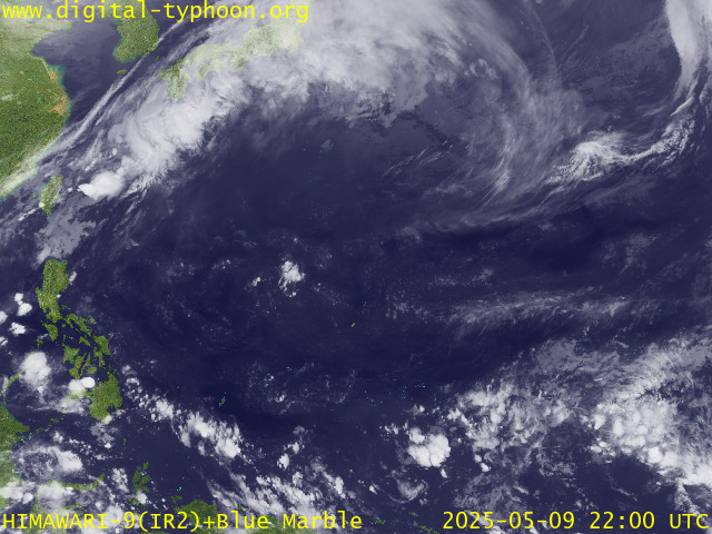
RECENT MTSAT-1R SATELLITE IMAGE:

> Image source: Digital-Typhoon.org (Nat'l. Institute of Informatics) (http://www.digital-typhoon.org )
__________________________________________________________________________________________
NOTES:

> Image source: Digital-Typhoon.
^ - JTWC commentary remarks (for Meteorologists) from their
latest warning.
latest warning.
* - Based on PAGASA's Philippine Storm Warning Signals,
# 4 being the highest. Red letters indicate new areas
being hoisted. For more explanations on these signals,
visit: http://www.typhoon2000.ph/signals.htm
** - Based on the Tropical Cyclone's Wave Height near
its center.
__________________________________________________________________________________________
>> To know the meteorological terminologies and acronyms
used on this update visit the ff:
http://typhoon2000.ph/tcterm.htm
http://www.nhc.noaa.gov/aboutgloss.shtml
http://www.srh.noaa.gov/oun/severewx/glossary.php
http://www.srh.weather.gov/fwd/glossarynation.html
http://www.nhc.noaa.gov/acronyms.shtml
__________________________________________________________________________________________
:: Typhoon2000.com (T2K) Mobile >> Powered by: Synermaxx
Receive the latest storm updates directly to your mobile phones! To know more:
Send T2K HELP to: 2800 (GLOBE & TM) | 216 (SMART & TNT) | 2288 (SUN)
Note: Globe & Smart charges P2.50 per message, while Sun at P2.00.
__________________________________________________________________________________________
For the complete details on TY KONG-REY (01W)...go visit
our website @:
> http://www.typhoon2000.com
> http://www.maybagyo.com
# 4 being the highest. Red letters indicate new areas
being hoisted. For more explanations on these signals,
visit: http://www.typhoon2
** - Based on the Tropical Cyclone's Wave Height near
its center.
____________
>> To know the meteorological terminologies and acronyms
used on this update visit the ff:
http://typhoon2000.
http://www.nhc.
http://www.srh.
http://www.srh.
http://www.nhc.
____________
:: Typhoon2000.
Receive the latest storm updates directly to your mobile phones! To know more:
Send T2K HELP to: 2800 (GLOBE & TM) | 216 (SMART & TNT) | 2288 (SUN)
Note: Globe & Smart charges P2.50 per message, while Sun at P2.00.
For the complete details on TY KONG-REY (01W)...go visit
our website @:
> http://www.typhoon2
> http://www.maybagyo
Change settings via the Web (Yahoo! ID required)
Change settings via email: Switch delivery to Daily Digest | Switch format to Traditional
Visit Your Group | Yahoo! Groups Terms of Use | Unsubscribe
SPONSORED LINKS
.
__,_._,___
No comments:
Post a Comment